

SUBSCRIBE TO OUR FREE NEWSLETTER
Daily news & progressive opinion—funded by the people, not the corporations—delivered straight to your inbox.
5
#000000
#FFFFFF
To donate by check, phone, or other method, see our More Ways to Give page.
Daily news & progressive opinion—funded by the people, not the corporations—delivered straight to your inbox.
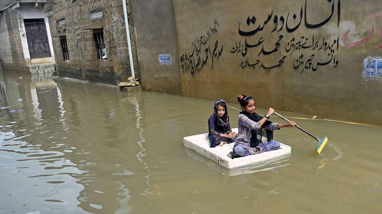
CNN reports that satellite photos show that the overflowing Indus has created a new body of water in southern Pakistan some 62 miles (100km) wide. It will take days or weeks for the water to recede, and in the meantime millions are left homeless and over all, 33 million people have been affected by the worst monsoon floods in recorded history. CNN quotes Pakistan's Climate Minister Sherry Rahman as saying "That parts of the country 'resemble a small ocean,' and that 'by the time this is over, we could well have one-quarter or one-third of Pakistan under water.'"
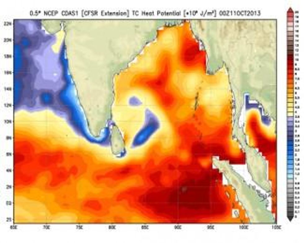
Because of our burning of fossil fuels to drive cars and heat and cool buildings, the world is heating up. But the Indian Ocean is heating up a third faster than the rest of the world. Very warm waters in the Bay of Bengal are helping create more destructive cyclones and flooding. The air over warming waters contains more moisture than the 20th century average. Warming waters also make the winds that blow over them more erratic, and wayward winds from the Arabian Sea helped push the heavy monsoon rains farther north than they usually extend.
We don't have to look far for the culprits. J. Blunden, and T. Boyer, Eds., 2022: "State of the Climate in 2021" Bull. Amer. Meteor. Soc., 103 (8), Si-S465, https://doi.org/10.1175/2022BAMSStateoftheClimate provides a state of the climate report for 2021.
It isn't good news. The concentration in the atmosphere of carbon dioxide increased another 2.6 parts per million, to a year-long average of 414.7 parts per million of CO2. We should be trying to get to zero increases of carbon dioxide, not increasing it. Arctic snow cores show that there hasn't been that must CO2 in the atmosphere for at least 800,000 years, i.e. nearly a million years. It turns out that if you go back to "1 million Years B.C." you don't find Raquel Welch, you find a steaming tropics of a world. The growth rate for methane was the highest on record. Methane is 25 times more potent than carbon dioxide as a heat-trapping gas, and CO2 isn't any slouch itself. Methane, though, dissipates quickly if you don't keep adding to it in the stratosphere, in as little as nine years. If you put carbon dioxide up there, though, it can last thousands and thousands of years. It is gradually absorbed by the oceans or igneous rocks, but he ocean may reach its capacity for absorption of CO2 in only 15 years, after which the stuff will just stay up there, making earth hot.
The report says that Death Valley, California, reached 54.4degC (130.46 F.) for the second time since records have been kept. Across the global ice concentrations or "cryosphere," glaciers lost ice mass for the 34th consecutive year. Now the BBC is predicting that in the near future the glacier ice lost will become so great that it will threaten the water supplies of Switzerland and other European countries.
And in horrific news for Bangladesh and Egypt, the report says, "Across the world's oceans, global mean sea level was record high for the 10th consecutive year, reaching 97.0 mm above the 1993 average when satellite measurements began, an increase of 4.9 mm over 2020."
Seas rising, carbon dioxide concentrations in the atmosphere rising to best a million-year-old-record, super-monsoons. We can change all this, but we have to hurry to shut down CO2 emissions quickly.
The most active Atlantic hurricane season on record began two weeks ahead of schedule and ended on November 30, 2020. Overall, this season was one for the record books. There were 30 named storms (meaning storms where top winds were 39 miles per hour or greater instead of the average 12). Of those storms, 13 were hurricanes (top winds of 74 mph or greater) and six were major hurricanes (top winds of 111 mph or greater). This season surpasses the previous record holder, 2005, which witnessed 28 storms and 15 named hurricanes, and marks only the second time in recorded history when meteorologists ran out of names before the season was over and had to resort to the Greek alphabet.
The 2020 season also forms part of a pattern that calls into question what even constitutes an "average" season. It is the fifth consecutive year with an above average hurricane season. According to the National Oceanic and Atmospheric Administration (NOAA), this year's record-breaking season was enhanced by La Nina, a global weather pattern that causes heavier storms in some areas and droughts in others. Research by climate scientists predicts that if greenhouse gas emissions continue to rise, the number of extreme weather events charged by La Nina and El Nino will likely rise as well.
Stronger hurricanes are also fueled by warmer air temperatures, which means the atmosphere can hold more rain, and by warmer ocean sea surface temperatures, which create the perfect conditions for hurricanes to grow stronger. While ocean winds often have something called vertical wind shear, which can essentially cut down a developing hurricane into smaller pieces before it can build into something dangerous, NOAA data shows that since the 1980s, vertical wind shear has become increasingly weaker in areas that are farther away from the equator, setting them up for stronger hurricanes.
Still, says Gabriel Vecchi, professor in High Meadows Environmental Institute at Princeton University, the most remarkable part of 2020 is how rapidly storms have progressed from mild to dangerous. "Over the past few decades, since the 1980s, in the Atlantic and around the globe, the percentage of rapid intensifications has increased," Vecchi said.
Storms were able to become dangerous so quickly this year because of how warm the ocean was in many regions of the Atlantic and Caribbean. "The impact of long-term ocean warming on rapid intensification is a major reason for long-term increases in the fraction of hurricanes reaching the highest intensity levels," said Timothy M. Hall, a senior research scientist at the NASA Goddard Institute for Space Studies.
A study led by James Kossin, an atmospheric research scientist at NOAA, and published in June 2020 in the Proceedings of the National Academy of Sciences, found a significant increase of roughly 32 to 39 percent between 1979 and 2017 of hurricane intensities measured at Category 3 and higher compared with measurements at any intensity. Put differently, they found a 6 percent increase per decade of a hurricane reaching "major hurricane" status, that is, Category 3 or higher.
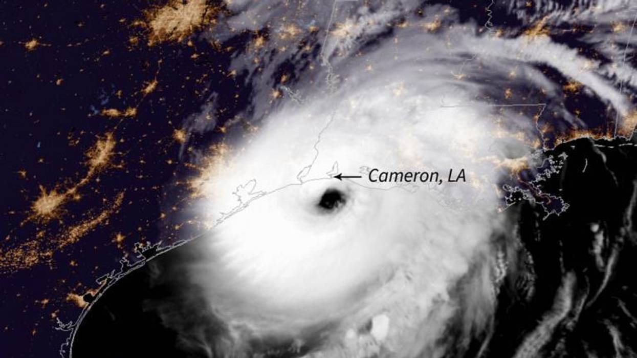
In the United States, Louisiana in particular bore the brunt of this year of storms. Five storms made landfall in the state--a new record. Hurricane Laura, which made landfall on August 26, was a Category 4. It struck Cameron (located between Houston and New Orleans on the coast) with 156 mph winds, destroying buildings and power infrastructure and inundating the region with a nine-to-12-foot storm surge. Six weeks later, on October 9, Category 2 Hurricane Delta hit just 20 miles east of where Laura had struck. Thousands of people were still living in shelters because their homes had been destroyed when Delta brought over-100-mph winds and over seven feet of storm surge.
Laura and Delta would have been much weaker if they had passed over a colder ocean on their way to Louisiana. "Both intensified rapidly over warm Gulf waters before Louisiana landfalls," Hall said. "Laura's intensification was especially rapid, and it occurred just prior to landfall." Hurricane Eta, which devastated parts of Nicaragua and Honduras, doubled in the 24 hours before it reached the coast.
The warmer air both hurricanes met on their journey to landfall also meant they caused more flooding. Hall said, "Hurricane winds blow over warm sea surface, causing evaporation of the seawater. The water vapor gets sucked high up in the storm, where it condenses and falls as rain." On average, says Michael Mann, professor of atmospheric sciences at Pennsylvania State University, atmospheric scientists expect to see a roughly 7 percent increase in moisture content for every 1 degree (Celsius) that air temperatures increase.
That extra rain causes problems even after the hurricane has left. Central America is still experiencing landslides due to the amount of rain following Category 5 Hurricane Iota, which dropped over 24 inches of rain on some regions of Nicaragua and Honduras when it arrived in mid-November. The earth was already saturated as a result of Category 4 Hurricane Eta, which hit the region earlier that month.
Eta and Iota also displayed another trend that climate change appears to be making worse--stalling. Like a party crasher who refused to leave, Eta stalled just off the coasts of Nicaragua and Honduras, without moving on or dissipating. A study Hall and Timothy K. Kossin (NOAA) published in Nature in June 2019 found that the average forward speed of hurricanes in the North Atlantic had decreased by 17 percent between 1944 and 2017. This shift led Dorian to devastate the Bahamas in 2019, Florence to douse the Carolinas in 2018, and Harvey to inundate Houston in 2017.
"Hurricanes are 'steered' by large atmospheric wind patterns, something like a cork in a stream," said Hall. "There's good reason to think that the guiding wind patterns are becoming weaker and more prone to stagnating in a warming climate. . . . In fact, we do see an increasing percentage of hurricanes stalling in recent decades."
Signs of stalling are visible not only in hurricanes in the Atlantic but also in tropical cyclones in the Indian Ocean, where the season began with Category 5 Cyclone Amphan, the strongest storm in the Bay of Bengal since 1999.
In late November, Cyclone Gati, a Category 2 storm, made landfall in Somalia--the first time a hurricane-strength storm made landfall in the country's history. In two days, Gati dropped the amount of rain that Somalia typically received in two years.
In the last days of November, Category 1 Cyclone Nivar formed in the Bay of Bengal and then struck Tamil Nadu and Chennai. It was the fourth storm in the region this year. The rains it brought, according to the Weather Channel India, were 188 percent above average between November 23 and 26. In November and December, this region was flooded by more rainfall than it usually receives in the monsoon season.
In the Pacific, the season was less active than the 2020 Atlantic season. (Typically, one region or the other is more intense.) Nonetheless, the Pacific experienced some intense storms marked by a similar pattern of rapid intensification. Vongfong (named Ambo in the Philippines) formed on May 10 and rapidly intensified into a Category 3 storm, hitting Samar Island, the third-largest island in the Philippines, on May 14, causing widespread flooding, washing out roads, and destroying crops.
In late October, Typhoon Goni (Rolly in the Philippines) rapidly intensified as a Category 5 storm struck Catanduanes Island in the Philippines, flooding buildings, bridges, and roads and destroying crops. Goni continued on, as a tropical depression, to Vietnam, where it also caused widespread flooding and landslides.
The rapid intensification of storms has made predicting disasters much harder, said Mann. "The hurricane forecasting models don't appear to capture rapid intensification episodes every well. It might be because of climate-change-related factors not in the models yet (for example, the penetration of heat further below the surface, which limits the churning up of cold waters that would otherwise slow or dampen development)."
"The net effect of this," said Mann, "is that it's hard to know days in advance just how much a hurricane will intensify before making landfall." Adds Vecchi, "It is a harder world to plan in. Either we will need to become better at forecasting or more nimble in responding."
As to what the meteorologists predict going forward, Kossin said, "the evidence continues to mount that hurricane behavior has changed over the past decades, and even the past century, and will continue to change over the next century as the climate continues to change. Globally, tropical cyclones are about 25 percent more likely to be at major-hurricane intensity now than four decades ago. The chances of rapid intensification in the 1980s was about one in 100 in the Atlantic. Nowadays, the chances are 1 in 20."

A storm that meteorologist Eric Holthaus characterized as "one of the strongest" cyclones in India's recorded history made landfall on Friday amid warnings of "potentially catastrophic" wind, rain, and ocean surges.
Over a million people were reportedly forced to evacuate Thursday as Cyclone Fani--classified as the equivalent of a Category 4 hurricane--hurtled toward India. Tens of millions of people are in the path of the massive storm.
"Meteorologists are calling the storm a near-worst-case scenario for coastal zones, as it will push an enormous storm surge inland, inundating homes, roads, and businesses near sea level--not just in eastern India but potentially also north into Bangladesh," the Washington Post reported. "This low-lying stretch of coast along the Bay of Bengal is one of the most vulnerable to storm surge in the world."
this is something scary effect of fani...
stey safe averyone #Odisha #CycloneFani pic.twitter.com/13XE8kHM8p-- lipun_12o8 (@Iamlipunk) May 3, 2019
Bishnupada Sethi, special relief commissioner for the Indian state of Odisha, told Al Jazeera that at least two people have died since the storm made landfall Friday.
Oxfam India, which is helping deliver emergency relief in response to Cyclone Fani, said the storm has already "wreaked havoc in the state of Odisha."
"Heavy rainfall and high-speed winds have destroyed livelihoods leaving families in urgent need of help," the group wrote. "They are in urgent need of safe drinking water, medical and hygiene supplies, food, and long-term recovery and rehabilitation support to cope with the disaster."
Bimal Pandia, an officer with Oxfam, told The Guardian Friday morning that the storm is "quite serious now; the wind is blowing at between 120 and 150km/hour."
Many trees have been uprooted outside our house," Pandia said, "but since we are not able to venture outside it's difficult to tell the damage."
When I was in Paris, I met with Kathy Jetnil-Kijiner, a poet and young mother from the Marshall Islands. Kathy told stories of king tides breaking through her coral island's seawalls, with water quietly rising into her sleeping cousin's bedroom before a huge wave came and knocked her house over. (If her cousin's mother hadn't woken her, she would've went with it.)
I also met with Esau Sinook, an 18-year-old Inupiat Native American who lives on a barrier island called Shishmaref off the northwest coast of Alaska. The island is losing 3-4 meters of land a year and houses are falling into the sea.
"There is an incredibly powerful symbol right now in Europe: the boat. This is in the newspapers all the time. We know what that means. It means someone, in the poetry of it, putting everything they have into a small container and setting off, unsure of where we're going." --Kevin BucklandI also met Zara Pardiwalla, of the Seychelles, whose island home in the Indian Ocean faces saltier soil and bleached corals, meaning fishermen have to sail further and further out to find better catch.
Here's the rub: We don't know what to call these people. There is no label for Kathy or Esau or Zara on the international stage.
One of the most contested parts of the Paris negotiations was the issue of climate refugees. The U.S. removed compensation from the table before the talks even started. Still, even before the final draft, there was mention of forming a "climate displacement facility"—some entity that could help the folks staring out at Island-ruining waves. That got cut, too.
What made it into the Paris agreement is a pledge to "address displacement related to the adverse impacts of climate change," with a report back penciled for next year's summit in Morocco.
While this pledge is as watered down as you can get -- it also represents a lifeline. To understand how to seize it and why it took us so long to get here.
Erica Bower, an expert on "Loss and Damage" with the advocacy group Sustain US, told me that there is "no universal word to describe what it means to be forced to flee from your home." As a result, she said, "there have been so many debates in the last decade about definitions that it's stalled progress."
"Because people have been so fixated on having the right term, they don't actually act, they don't actually create the infrastructures that are needed to support these populations."
Some people want to use the phrase "climate migrants" while others want to use "climate refugees," and yet others want to use "disaster displaced person."
While "climate refugee" has the most punch to it, it's riddled with problems. As Bower explained it, one of those problems are that the phrase "climate refugee" implies sole causality when often climate change is an exacerbating force that worsens economic and political drivers (think: the Syrian refugee/war crisis and the 4-year record drought that preceded it).
Another major problem with the term "climate refugee" is it removes agency. According to Bower, "climate refugee" paints someone as a victim whereas people in Kiribati want to be described as "climate warriors" -- as people who have tremendous resilience and who will fight to stay in their country as long as they possibly can.
Without a name, it's been nearly impossible to rally for the world's first climate lost -- the people who are fleeing a planet that's gotten a lot tougher to live on. Kathy, Esau, and Zara still have homes, but since 2008, at least 22.5 million people were displaced each year because of sudden extreme weather events -- floods, typhoons, cyclones, and the like. That number is over double what it was in the 70s, and is a tenth of the 200 million climate-pushed migrants expected by 2050.
So, as we find footing after Paris, the question is: How do we find footing for the people who can't go home anymore?
The answer, I believe, lies somewhere at the juncture of an honest reckoning of loss, and a more nuanced struggle for justice.
As a movement, we've been stuck with the idea that we can fully and completely stop climate change. The waves of climate displaced--those we struggle to categorize or name properly--represent to at least some degree our failure as a movement to date. It's a failure we need to acknowledge, but more so it means that as we fight for the death knell of fossil fuels, we've now got to include justice for the survivors of a broken world for whom the renewable energy transition will simply come too late.
We saw the start of this evolution in Paris, where the final "D12" action included laying out long red canvas banners on the cobbled streets.
The red lines action began at the "tomb of the unknown soldier," where an eternal flame burns. People paid respect for climate change's victims—past and future—by dropping red tulips on the long banners.
The end of Paris showed a reckoning of human losses, an evolution from the naivete of saving the world, to trying to survive this one as best we can. While this work will include seeing through "the beginning of the end of fossil fuels," it now must also evolve into a global fight for the survivors -- for the displaced.
One other factor can help us seize the Paris lifeline. Symbols may offer a workaround since we've been stuck with clunky vocabulary.
Kevin Buckland, 350.org Arts Ambassador, described how symbols can act as containers for the losses and rallying cries we can't yet name.
Kevin told me about a new symbol that's been taking shape. "I think there is an incredibly powerful symbol right now in Europe, which is the boat," Buckland said. "This is in the newspapers all the time. We know what that means. It means someone, in the poetry of it, putting everything they have into a small container and setting off, unsure of where we're going."
New symbols that show humans in the crosshairs, like the boat, can maybe help us break the decade-long logjam to need the right words and incite the loud movement that is actually what we truly need to help the world's first climate homeless.
One of the oldest symbols of the climate fight, the polar bear, seems like it may have run its course.
At the end of our interview, Kathy, the Marshall Islands poet, told me:
"So, for people whose islands might be drowning, is that symbol not strong enough? Because polar bears are cute, you care more about them?"
Last month I wrote two articles (here, here), gave an interview to The Real News Network (here), and an interview to Uprising Radio (here) about the devastating floods in Colorado. With Boulder as its epicenter, the floods damaged more than 2,000 squares miles along the Colorado Front Range--from Colorado Springs to Fort Collins. Ten people were killed, nearly 18,000 homes were damaged or destroyed, hundreds of miles of road were washed out, and thousands of oil and gas wells flooded resulting in environmental contamination from toxic fracking fluids and nearly 40,000 gallons of spilled oil. Boulder got nearly its annual average rainfall in just five days, and it happened at a wrong time--September, not July/August, when rain usually falls in the desert southwest.
My main contribution was to raise the noise level that the corporate media had failed miserably in its reporting of the Colorado floods. Not a single journalist had raised the question on corporate TV: Did global warming play a part in causing or intensifying the Colorado floods?
Bamboozled by the lure of technology, humans have become deeply amnesic. We forget a tragedy soon after the corporate media stops reporting on a particular catastrophe. In a globally warmed Earth, however, before amnesia sets in, the next assault arrives.
This morning I woke up to the news of super cyclone Phailin in the Bay of Bengal that will make landfall tomorrow in the east coast of India. "Odisha and Andhra Pradesh braced for the "very severe" cyclone [Phailin] that is expected to hit the east coast with winds gusting up to 220 kmph [136 mph] tomorrow evening, as lakhs [1 lakh=100,000] of people were being evacuated to safer places and the military kept on standby," The Hindu reports.
I had lived in the American southwest for eleven years, and I was born and grew up in Bengal. So, the recent Colorado floods and the super cyclone in the Bay of Bengal are personal.
There are already many news articles on the India cyclone that you can read: The Hindu here, Times of India here, India Today here, BBC here, Washington Post here. I won't go into the details; instead, I'll focus on bringing attention to two things: naming and blaming.
Apparently Phailin was named by Thailand and it means sapphire in Thai. What nonsense. Some humans do desire the precious stone, but no one, I'd think, is desiring Phailin. India should rename this meaningless obfuscation and call attention to global warming immediately.
There was also some confusion about whether this is a 'cyclone' or a 'super cyclone'. On Thursday the India Meteorological Department had "indicated that the wind speed would be limited to 185 kmph." But now the forecast is at 220 kmph, and the US Navy has indicated that the "wind speed will be above 240 kmph." So before the cyclone makes a landfall, it will turn into a deadly super cyclone--yet another example of extreme weather event.
The India Today has posted a very useful article "What is a super cyclone?" The article gives an excellent explanation of the 1999 Odisha super cyclone, also known as Cyclone 05B. "It struck the coast of Odisha with a height of [ocean water] 26 feet (8 meters). Approximately 275,000 homes were destroyed leaving 1.67 million people homeless. Another 19.5 million people were affected by the super cyclone to some degree. A total of 9,803 people officially died from the storm. Though it is believed that 15,000 people died," the India Today reports. The article also mentions how the rescue operation proceeded. By placing this article in the context of the impending super cyclone in the exact same landscape, journalists in India are doing a better job than how the Colorado floods were reported last month. But it could be better, it needs to better, and make an explicit connection to global warming.
India Today explained: "Tropical cyclones typically form over large bodies of relatively warm water. They derive their energy from the evaporation of water from the ocean surface, which ultimately recondenses into clouds and rain when moist air rises and cools to saturation." There is our clue--connection of the impending super cyclone with global warming. All the articles I have come across on the impending Bay of Bengal cyclone, however, avoided using the phrase--global warming.
The anthropogenic global warming caused by accumulation of greenhouse gases is making the oceans warmer, which in turn is causing more frequent and more intense cyclones/hurricanes and floods.
The UN IPCC Fifth Assessment Report's (AR5) first part, the Summary for Policymakers (SPM), was released two weeks ago. More than a 1,000 scientists from all over the world contributed to the report, and the team worked for six years. The SPM was approved by 190 nations. All that means that the IPCC AR5 is a conservative estimate of global warming. The reality will likely be worse than what the IPCC is saying.
Having said all that, the IPCC reports states: "Ocean warming dominates the increase in energy stored in the climate system, accounting for more than 90% of the energy accumulated between 1971 and 2010 (high confidence). It is virtually certain that the upper ocean (0-700 m) warmed from 1971 to 2010..."
India-based Dr. Rajendra Pachauri has been, since 2002, the chairperson of IPCC, which was awarded the Nobel Peace Prize in 2007. I'd urge Dr. Pachauri to go on TV and explain the anthropogenic warming of oceans and its relevance to the impending super cyclone in the Bay of Bengal that will undoubtedly bring massive deaths--humans and nonhuman species--and devastation.
India must rename Phailin and connect the impending super cyclone to global warming.
Developing...
India is bracing for "very severe" Cyclone Phailin, a potentially catastrophic storm now barreling across the Bay of Bengal, threatening the safety of millions.

Developing...
India is bracing for "very severe" Cyclone Phailin, a potentially catastrophic storm now barreling across the Bay of Bengal, threatening the safety of millions.
Tens of thousands of people in the eastern states of Andhra Pradesh and Odisha (also referred to as Orissa) are being evacuated in preparation for the rapidly intensifying storm that has grown to half the size of India.
Winds are currently gusting as high as 190 miles per hour, and meteorologist Eric Holthaus warns that Phailin already officially reached Category 5 status. He adds:
Should the storm maintain its current strength--or strengthen even further--India could be facing a true catastrophe. A worst case scenario would have Phailin tracking slightly eastward of its current forecasted track, toward Kolkata and the Ganges Delta of Bangladesh, which is home to tens of millions of people living just a few meters above sea level.
The Indian Meteorological Department predicts Phailin will make landfall on Saturday evening, bringing with it up to 140 mile per hour winds, as much as 10 inches of rain, and storm surges of about 10 feet above normal tides, though climatologist and storm surge expert Hal Needham warns that
Phailin has the potential to generate a surge at least 6 meters (20 feet) high. This surge height would be comparable to the storm surge generated by the Galveston Hurricane of 1900. This storm devastated Galveston Island, Texas, killing between 6,000 and 8,000 people in the deadliest natural disaster in U.S. history.
Meteorologist Jeff Masters reports that "Phailin is likely to be the strongest tropical cyclone to affect India in fourteen years, since the great 1999 Odisha Cyclone" that killed over 10,000 people.