The Climate Crisis Won't Let the Political Cycle Ignore It for Too Long
But it’s never occurred to me that this state of affairs would last very long—physics is running this show, and it won’t be long denied. And now I think we can see the next of these cycles firing off—and this one, I think, will be climactic. We have a chance to insure that civilization comes out of this one focused on the physical world.
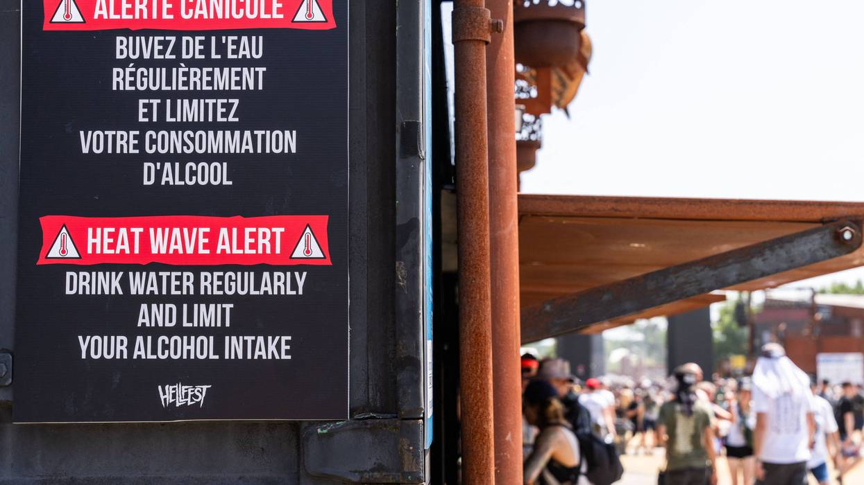
The politics of climate begins with… climate. Perhaps you’ve heard that Europe spent the past week suffering through a truly remarkable heatwave, with France reaching a new all-time record temperature, the UK recording its hottest day ever, Spain smashing all its old marks. It’s truly brutal—and it recalls, for Europeans, the heatwave of 2003, which ended up killing 70,000 people. Even today, the continent is ill-prepared for extreme heat—in France, for instance, Angelique Chrisafis reports that:
The impact of the heatwave has been made considerably worse by the high proportion of French buildings and infrastructure not designed to cope with high temperatures. Paris, one of Europe’s most densely populated cities, known for its poorly insulated housing stock, has for years been considered to have the highest heatwave mortality risk of any capital on the continent. The French government has been criticised for a lack of preparation and for cutting funding for projects designed to adapt infrastructure to the climate crisis.
Half of all French homes have insufficient protection from high temperatures, leaving inhabitants dangerously overheated, a report for the NGO Fondation pour le Logement (Foundation for Housing) found this month. About 66% of French people struggle to tolerate the heat in their homes.
Maïder Olivier, the head of climate advocacy at the NGO, said France had a “massive and worsening problem of heat-trap housing.” She said climate inequality in France was growing, with low-income, suburban housing estates suffering the worst from heatwaves.
Apparently English homes, especially modern ones, aren’t much better. And the heat has caused a surge in British hospital admissions, even as it’s damaged hospital equipment. Andrew Gregory writes:
Several NHS trusts in England have declared critical incidents as a direct result of the extreme heat. One hospital had done so after its machines failed in multiple areas, a doctor said. Labs used for testing were also affected and two linear accelerator machines, used to treat cancer patients, had stopped working amid the high temperatures.
The doctor said that although they were working in a relatively new care setting, it was “tacked on to an old Victorian hospital,” creating severe infrastructure challenges. “It’s hopeless, really,” they said.
The doctor also said their NHS trust had faced “major issues” with IT servers overheating on Wednesday. “We thought we were going to lose everything, so we were all asked to turn off non-essential computers and electrical equipment, including lights.”
But it’s not just dialysis machines going down—in France, nuclear reactors had to be taken offline because the river water used for cooling was getting too warm. Also, save some tears for the poor American tourists complaining to The Wall Street Journal that European restaurants offer too few ice cubes in their drinks.
Look, there’s no doubt why these records are being smashed—as Bob Henson writes at Eye on the Storm:
Extreme heat is among the most-studied consequences of human-caused climate change, and the connections between a warming planet and amplified, localized extreme heat are not only intuitive but well documented.
In this case the jet stream—powered by the temperature differential between the poles and the equator, and unsettled by the melt up north—has gone kaflooey, producing what’s called an “omega block” for its distinctive shape. The sun beating down on this heat dome is relentless. As Lauren Dalban reports for Inside Climate News:
“There’s a sad inevitability to all of this, with scientists like me trotting out the same quotes year after year,” Friederike Otto, a professor of climate science at the Imperial College London who leads the World Weather Attribution, a group that works to link weather events to climate change, said in an email. “Simply put, we remain on a one-way trip towards a more dangerous future, and it’s time we hit the brakes.”
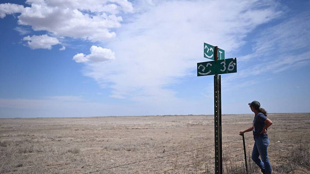
I could of course go on and on about the heat; it’s wretched. (And remember that we’re paying attention in part because there’s lots of media, some of it English-speaking, in Europe; similar hideous heatwaves have been plaguing much of Asia this spring). But what I really want to talk about is its political meaning—I think this heatwave is one of those events that will help bring “climate” back into fashion in our discourse.
Britain will be an interesting test case. Its politics have been roiled for the last two years by the odd static incompetence of Keir Starmer’s Labour government, now about to be replaced by the Andy Burnham government. A key question for that new administration will be the role of Ed Milliband, who has been serving as the energy secretary, and may be in line for a job as chancellor. He’s been (almost uniquely) effective in his role, moving fast to boost clean and cheap renewable energy in the UK.
But that’s roiled the fossil fuel industry, which is putting big money behind the right-wing Reform Party, which, according to an April investigation by Sam Bright and Adam Barnett, has collected two-thirds of its funding from oil interests. Together with the always vile Murdoch press, they’ve mounted a full-on attack on “Net Zero” policies, alleging—a la Murdoch’s Wall Street Journal in this country—that they’re responsible for rising energy prices in the UK.
The entire status quo is in on this fight—including British labor unions. They aren’t venal the way oil companies are, but they are fighting against change, in the name of their current members. And they’ve focused their fire on Milliband. Sharon Graham, head of the giant UNITE union, has said:
Jobs in Britain are important. We need someone in that role [chancellor] who understands that, and at the moment that isn’t Ed Miliband… It’s been floated that Ed Miliband would be chancellor, that would be a noose around the neck of what we need to do on jobs.
Happily, we’re starting to see serious pushback to this endless irresponsible climate delayism. It begins with scientists. In France eminent climate researchers have started speaking out to Le Monde, complaining about the inability of scientists to effectively connect the dots between climate change and heat for the public. British scientists have gone one better: Nine of them wrote the agency responsible for regulating the press to complain about the lame coverage:
News stories about heatwaves often do not mention the influence of climate change or the burning of fossil fuels on increased temperatures—for example, 3 in 5 stories during the May heatwave did not—while two-fifths of those about net zero make no mention of climate change. In this context, it is unsurprising that the public often do not understand these issues or the connection between them.
I think my favorite was a letter to the London Times from the veteran climate research Brian Hoskins of Imperial College London, which I reprint here just because I like its cadences:
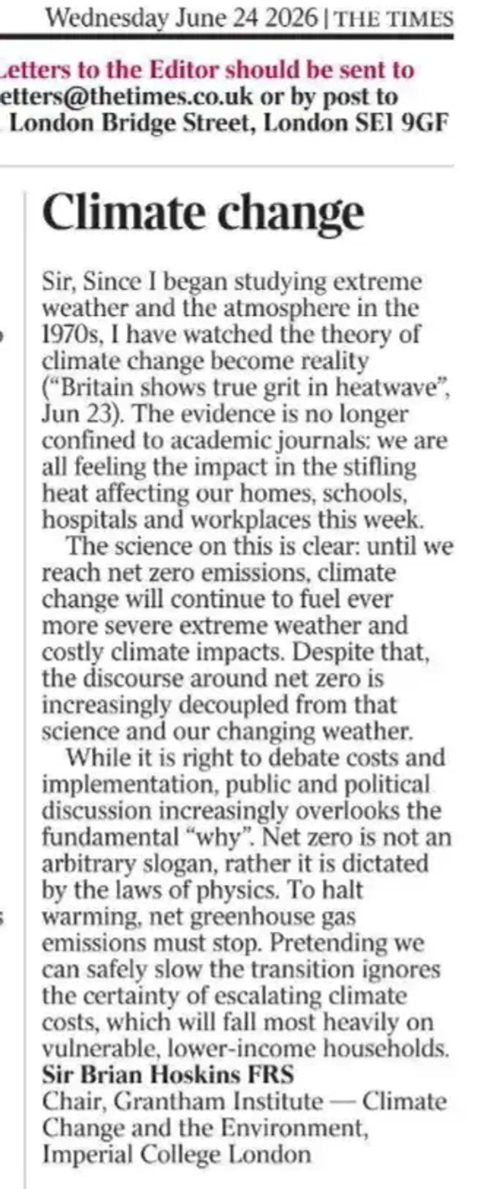
The sentence “net zero is not an arbitrary slogan, rather it is dictated by the laws of physics” should be a watchword in the years to come.
And here’s my guess: Milliband will be vindicated, landing in an important new job. Despite the complaints of union leaders, Britain’s green economy is one of the few things that’s booming on the island. He’s not backing down: At a press conference last week he heralded the fact that more than a hundred billion pounds in private clean energy investments had been made during his term:
Experts told The Guardian that the new investment data, as well as previous findings by the Confederation of British Industry that the UK’s net zero economy had grown faster than the rest of the economy and generated higher-paying jobs… [contradicted the claims of union leaders]
Miliband said: “I’m proud to have led a pro-business, pro-growth department in these last two years. This achievement didn’t happen by accident, but because of clarity of mission, government investment, and building not blocking. As we have shown in energy, progressive government in hard times requires partnership with business to secure economic growth, built on an active industrial strategy.”
Indeed, 40 progressive economists in the UK wrote to the labor leaders this week, rejecting their attack on Net Zero:
There is no alternative to the green transition. The effects of climate change are with us now. Miliband is right to oppose further expansion of North Sea oil and gas.
If Burnham were to back off the Net Zero pledges, he’d be disappointing the 60% of Brits who like the strategy. Starmer staggered in part because he took right-wing positions on immigration, giving the Green Party an opening; that door will grow much larger if he backs off on climate policy, so I suspect he won’t.
And the heatwave will give him political cover to do the right thing. As the head of Greenpeace UK said last week:
The only way off this hellish treadmill is to reduce our dependence on fossil fuels. Our next prime minister needs to act on the evidence outside their window, and the advice of their scientific advisers, and stay the course on climate policies. The alternative is parched reservoirs, unaffordable food, shuttered hospitals and schools, and wildly fluctuating bills each time a new oil war is kindled.
My further guess is that the coming El Niño will have the same effect on global climate politics—and maybe even in our caboose of a nation. We enter this new warming spell in rough shape: Recent data shows the heat content of oceans at all-time highs. Things are grim enough that one (ghoulish?) investor has launched a fund designed to make money off the coming crisis:
Hedge fund Moreton Capital Partners is targeting $500 million for a special-purpose vehicle to trade multiple commodities that stand to be impacted by the weather phenomenon, including South African corn, Malaysian palm oil, and Australian wheat. The markets are underestimating risks, according to Moreton’s co-founder Les Finemore.
“We think it’s going to be a dramatic reshaping of the global food situation,” Finemore said in a video interview from Mexico City. “We feel like today the market is seriously mis-pricing that risk.”
American politicians may feel that the easiest course for the short term is to back off on climate talk—and the green movement is perhaps inclined to let them get away with it through the midterm elections, which will be fought largely as a referendum on the mendacity of the Trump administration. (Though it’s political malpractice not to be calling out Trump’s incredibly unpopular attacks on solar and wind energy). But next year, as primary season begins in earnest, El Niño will insure climate is firmly back on the agenda. And given the explosion in clean energy, the case will be easy for smart candidates to make.
That this cycle has gone on since the 1980s does not mean it can go on forever. We’re clearly reaching desperate physical tipping points. So this had better be the last turn of the wheel—by the end of the decade we need to have decisively broken the political power of the fossil fuel industry, so we can get on with the energy transition, and with building a world that can survive the damage Big Oil has inflicted.
It starts now.