SUBSCRIBE TO OUR FREE NEWSLETTER
Daily news & progressive opinion—funded by the people, not the corporations—delivered straight to your inbox.
5
#000000
#FFFFFF
To donate by check, phone, or other method, see our More Ways to Give page.


Daily news & progressive opinion—funded by the people, not the corporations—delivered straight to your inbox.
A climate scientists weighs in on what we can and can't expect from an El Niño supercharged by the climate crisis.
On Saturday August 22, the world’s ocean surface temperature was the hottest it’s ever been recorded—just a fraction under 70°F. As the ocean continues warming, I and Vicki Nichols Goldstein of the Inland Ocean Coalition interviewed weather and climate scientist Daniel Swain who is affiliated with the University of California’s California Institute for Water Resources and the National Science Foundation’s National Center for Atmospheric Research. We spoke with him on our Rising Tide Ocean Podcast. Here is an excerpted version of that conversation:
David Helvarg: Before we get into our rapidly heating ocean and its impacts onshore and off, give us some background.
Daniel Swain: I started out as a weather geek, even as a kid. When I went to UC Davis for an undergraduate degree in atmospheric science, I thought I might become a federal meteorologist with the National Weather Service. But at some point, I realized that some of the really big questions, both intellectually interesting and societally important, were at this weather-climate interface. We can predict the weather really well, but the climate is changing. What does that mean for the weather?
So, I came into climate from the weather side—day-to-day weather changes and operational forecasting. I still get to wear that weather-geek hat pretty regularly, even though today I would call myself a climate scientist. I exist at that boundary between weather and climate, which of course is not very distinct to begin with. It’s all the same fluid atmosphere and the same fluid ocean, just different densities.
If funding becomes dependent on whether a research topic aligns with the political priorities of whoever happens to be president, that fundamentally changes the scientific enterprise. It is difficult to overstate how destructive and dangerous that could be.
I’ve been known to call the ocean, “the atmosphere, but upside down and wet.” That comes from an Earth-system perspective. The atmosphere, ocean, biosphere, and cryosphere (frozen water) aren’t really distinct elements. That becomes more obvious with each passing decade as we try to predict and model these different Earth systems and discover we can’t do it very well unless we connect them. We can’t predict the atmosphere very well unless we connect it to the ocean, and vice versa.
Helvarg: So, let’s start at that large scale. People don’t necessarily think of the ocean as a driver of climate and weather, even though it covers more than 70% of the planet.
Swain: Exactly. We live on a water planet even though we don’t really think of it that way. Fundamentally, that is what Earth is. The fact that more than 70% of the planet is covered by water means that long-term variations in the atmosphere are largely driven by what’s happening in the ocean.
Climate change, as we think about it, is actually, to a first order, ocean warming. The majority of the accumulated heat is going into the oceans. Then it affects the atmosphere as some of that heat comes back out of the ocean and comes back to bite us on land. One way to think about global warming is that it is primarily a tremendous amount of extra energy accumulating in the oceans and then spilling over into the remaining third of the Earth that isn’t ocean covered.
Vicki Nichols Goldstein: We know that about 90% of the excess heat is being stored in the ocean. Why can the ocean absorb so much heat compared to land?
Swain: First, because most of the planet is ocean. If you’re warming the whole sphere, most of that warming is going to involve the ocean simply because that’s most of the planet. But there’s more to it. Water has an enormous specific heat capacity. It can absorb an incredible amount of energy compared to an equivalent mass of soil or rock. It can also absorb that energy over a very deep layer.
On land, we talk about geology over millions of years—mountains building and collapsing, continents colliding and diverging. But over a few decades, that’s not happening to a meaningful degree. The ocean moves much more rapidly. An individual water molecule at the surface can end up in the atmosphere through evaporation or thousands of feet down in the deep ocean within a couple of years. The ocean is therefore very good at transferring energy from the surface to the depths.
It’s not just that the ocean covers 70+% of the planet and absorbs a lot of the increased warmth at the surface. Through vertical circulation and currents, it transfers some of that heat downward and redistributes it across the planet—longitudinally, latitudinally, and vertically.
The atmosphere overturns very quickly. A cumulus cloud can go from your house up to 20,000 feet in 20 minutes during a thunderstorm. The ocean takes longer, but significant movement can still occur over weeks, months, and years. On land, comparable movement can take millennia to millions of years. That’s why the ocean and atmosphere are tightly coupled. They interact causally, bidirectionally, and continuously.
Helvarg: People also have a hard time grasping how rapidly this change has occurred. Since we began burning fossil fuels just a few centuries ago, we’ve been changing the physical nature of the ocean—its temperature, chemistry, circulation, even its color. What does increasing ocean heat mean in terms of marine heatwaves?
Swain: Marine heatwaves really just mean anomalously warm ocean temperatures. Usually, we’re talking about the surface ocean because that’s what we can observe most readily and where these heatwaves are often most pronounced. We’re seeing them emerge with much greater frequency, intensity, and spatial connectedness, year after year and decade after decade. Unfortunately, I don’t see that stopping.
We’re going to see continued acceleration in marine heatwaves for as long as planetary warming continues. And marine heatwaves can have a lot of staying power because the oceans evolve more slowly than the atmosphere. You get a blob of unusually warm water and, except under unusual circumstances, you can’t just blow it away with a strong wind the way you might end a heatwave over land. A large marine heatwave can take days, weeks, or months to dissipate because there’s so much thermal inertia in the ocean.
Ironically, that persistence is also part of why the ocean helps us predict the atmosphere. The ocean varies more slowly. It has more “memory,” and therefore its variations can exert a persistent influence on the atmosphere. At a fundamental level, as the air warms, the ocean beneath it is going to warm too—although it will warm more in some places than others because of ocean currents, circulation, and atmospheric conditions.
Goldstein: We hear a lot about La Niña and El Niño. What is actually happening during that transition?
Swain: El Niño and La Niña are parts of a broader pattern of natural ocean variability called the El Niño-Southern Oscillation, or ENSO.
El Niño is the warm phase. La Niña is the cool phase. Essentially, we’re talking about whether the eastern tropical Pacific, particularly the ocean off Peru and South America, is warmer or cooler than usual. That’s a region where there’s normally a lot of coastal upwelling, with cold water moving vertically upward from the deeper ocean. Despite being in the tropics, this keeps coastal temperatures relatively moderate.
During El Niño, that cold-water upwelling weakens as warm water from the western Pacific literally sloshes eastward, sometimes thousands of miles. The prevailing easterly winds that help drive the upwelling can also weaken or even reverse. When the eastern tropical Pacific warms substantially, that is fundamentally El Niño.
But the reason it matters globally is that ENSO performs something like a thermostat function in the global climate system. During La Niña, heat gets stored below the surface in the tropical Pacific. During El Niño, some of that accumulated heat is released from the ocean into the tropical atmosphere, where it spreads through the rest of the climate system.
Swain: Because El Niño unleashes stored energy from the tropical ocean, it increases the global average temperature. And in a warming world, when you put a big El Niño on top of long-term global warming, you increase the likelihood of new global temperature records. It also accelerates the hydrologic cycle.
The warmer the air, the greater the potential swings between extreme wet and extreme dry. Warmer air can hold more water vapor. It doesn’t necessarily do so everywhere, but it raises the ceiling on how much moisture can be present. That raises the ceiling on extreme precipitation events, but also on extreme drought and wildfire conditions in different places and at different times. Some parts of the world see increased flood risk during El Niño. Other places see increased drought risk. El Niño shifts weather patterns while global warming increases the potential magnitude of whatever those patterns produce.
Helvarg: Here on the West Coast, my experience with El Niño has generally meant more storminess. How strong is that relationship?
Swain: El Niño in general exerts a meaningful but sometimes hard-to-pinpoint influence on California because it’s just one of many relevant factors. But with a very strong El Niño, I think it’s a different story.
This is a message I’ve tried to communicate to people in emergency management and policy. Recent El Niño events haven’t always produced the canonical effects people expected. The 2015-16 El Niño, for example, was one of the strongest ever observed in the tropical Pacific, but we did not see extremely strong impacts in California. Some people took that to mean, “Well, what does El Niño really mean anyway?” My answer is: not much if it’s weak. But if it’s strong or very strong, it should significantly tilt the odds.
It can mean a significantly warmer California nearshore ocean. It can mean temporarily elevated local sea levels, increasing the risk of coastal flooding and marine heatwave impacts. And in winter it can significantly increase the odds of a wetter-than-average California winter, potentially even a very wet winter with increased flood risk.
But if you asked me for one single predictor in the global climate system that could provide three to six months’ advance notice of the potential for a very wet California winter, it would be a very strong El Niño.
Goldstein: What does that mean for mountain snowpack in California and across the West?
Swain: This is where things get tricky because precipitation means different things in a warming world. You can have a winter that isn’t particularly dry and still have very low snowpack because it’s simply too warm. Some places can actually be wetter than average and still have unusually low snowpack. So, a strong El Niño may increase precipitation in California, including the Sierra Nevada, and could bring needed water to parts of the Colorado River Basin.
But more precipitation doesn’t necessarily mean more snow (if it rains). We may see above-average precipitation in some mountainous regions while still seeing below-average snowpack. That can help alleviate drought, but it’s a very different picture from a cold, snowy winter.
Helvarg: Jumping from the Pacific to that other still-significant ocean, the Atlantic: Strong El Niño events are supposed to suppress Atlantic hurricanes. Is that right? And why?
Swain: This is a good example of global warming and El Niño pushing in different directions. El Niño usually decreases Atlantic hurricane activity, mainly because of its effect on vertical wind shear rather than temperature. Tropical cyclones don’t like strong winds at upper levels of the atmosphere because those winds can literally decapitate storms—shear them apart. El Niño tends to increase wind shear in the Atlantic hurricane development region, making it more difficult for hurricanes to form and strengthen.
But there’s a big asterisk. If you have record-warm waters in places like the Gulf of Mexico, and a storm manages to develop during a brief period when wind shear is low, you can still get an extremely strong hurricane. So, a strong El Niño may suppress the overall hurricane season, while exceptionally warm ocean water can supercharge a storm that does manage to develop.
That’s a good example of natural variability—El Niño and the Southern Oscillation—interacting with the decidedly unnatural long-term warming trend to produce outcomes we haven’t seen very often before. It’s also why, despite all our advances in prediction and historical data, science still has a lot to learn.
Goldstein: That brings us to science itself. The Trump administration is changing Office of Management and Budget rules in ways that could make federal research funding reflect presidential priorities. How does that affect climate research and communication?
Swain: This goes far beyond weather, climate, and oceans. It affects any domain requiring expert knowledge to make important decisions—from health to public policy to research funding. There has been a lot of focus on research funding, but it’s important to emphasize that this affects everything.
The degree of alarm in academic and research institutions is significant. Changes that politicize the federal grant system could make us vastly less able to understand how the world works and prepare for future contingencies—whether storms, floods, pandemics, or geopolitical disturbances. It also becomes much harder for people in science to remain nonpartisan and simply focus on their research.
If funding becomes dependent on whether a research topic aligns with the political priorities of whoever happens to be president, that fundamentally changes the scientific enterprise. It is difficult to overstate how destructive and dangerous that could be.
Goldstein: That’s why people have to follow these issues, raise their voices, and try to hold the line.
Helvarg: Democracy doesn’t guarantee that we’ll be good ocean stewards or base public policy on sound science. But without democratic means, it becomes far harder to move forward on existential challenges like climate change and ocean protection.
"Food is going to become less affordable, and consumers should be prepared for it," said one expert.
US shoppers have been struggling with the price of groceries for years now, and prices are only set to climb higher in the coming months.
As reported by Bloomberg on Wednesday, a combination of President Donald Trump's tariffs, his illegal war with Iran, and a potential "super El Niño" weather pattern is projected to lower food supply while increasing food production costs, all of which will mean higher prices at US grocery stores.
According to Bloomberg, weather forecasters are now projecting that an unusually strong El Niño will form in August "that will persist into 2027 and push global average temperatures higher," potentially causing droughts in nations that grow staple crops such as rice, coffee, and cocoa.
And even without an El Niño, noted Bloomberg, farmers in the US have already endured the warmest-ever start to a planting season, which "prompted some domestic crops to begin blossoming weeks ahead of schedule instead of remaining dormant throughout the winter, leaving them exposed to subsequent frosts."
Ricky Volpe, agribusiness professor at California Polytechnic State University, told Bloomberg that 2026 would be a "challenging year" for agriculture, warning that "food is going to become less affordable, and consumers should be prepared for it."
Unusually warm weather isn't the only factor pushing up food prices. In a report published earlier this month, The New York Times found that Trump's tariffs on foreign steel have been pushing up prices of canned foods.
According to data from the US Bureau of Labor Statistics (BLS), the price of canned fruit and vegetables in March posted 5.7% increase from the year before, driven in large part by a tariff-induced rise in tin plate prices.
"Over 80% of the tin plate used in the United States last year was imported, according to Harbor Intelligence, a metals markets analysis firm," noted the Times. "Tin plate is produced in much lower volumes than the steel used to make cars and buildings, making it a less attractive business for large steel companies."
While Trump has tried to brush off the rise in grocery and fuel prices in recent weeks—going so far as to say "I don’t think about Americans’ financial situation"—his Republican Party is bracing for potential political consequences.
CNBC reported on Wednesday that the GOP is staring down an inflation "abyss" and fears that Democrats are well poised to at least retake the US House of Representatives.
Rep. Don Bacon (R-Neb.), who is retiring at the end of this term, told CNBC that his fellow Republicans have been unwilling to serve as a check on what he described as Trump's self-destructive tariffs that had hit Americans' pocketbooks.
"I think tariffs are bad policy," said Bacon. "Milton Friedman, Adam Smith, they’re the bibles of conservatism, and we have violated those... We should not have rolled over on that here in Congress."
Hegseth once again chided US allies for not getting involved in the war, which has created severe shortage of jet fuel and forced European airlines to enact mass flight cancelations.
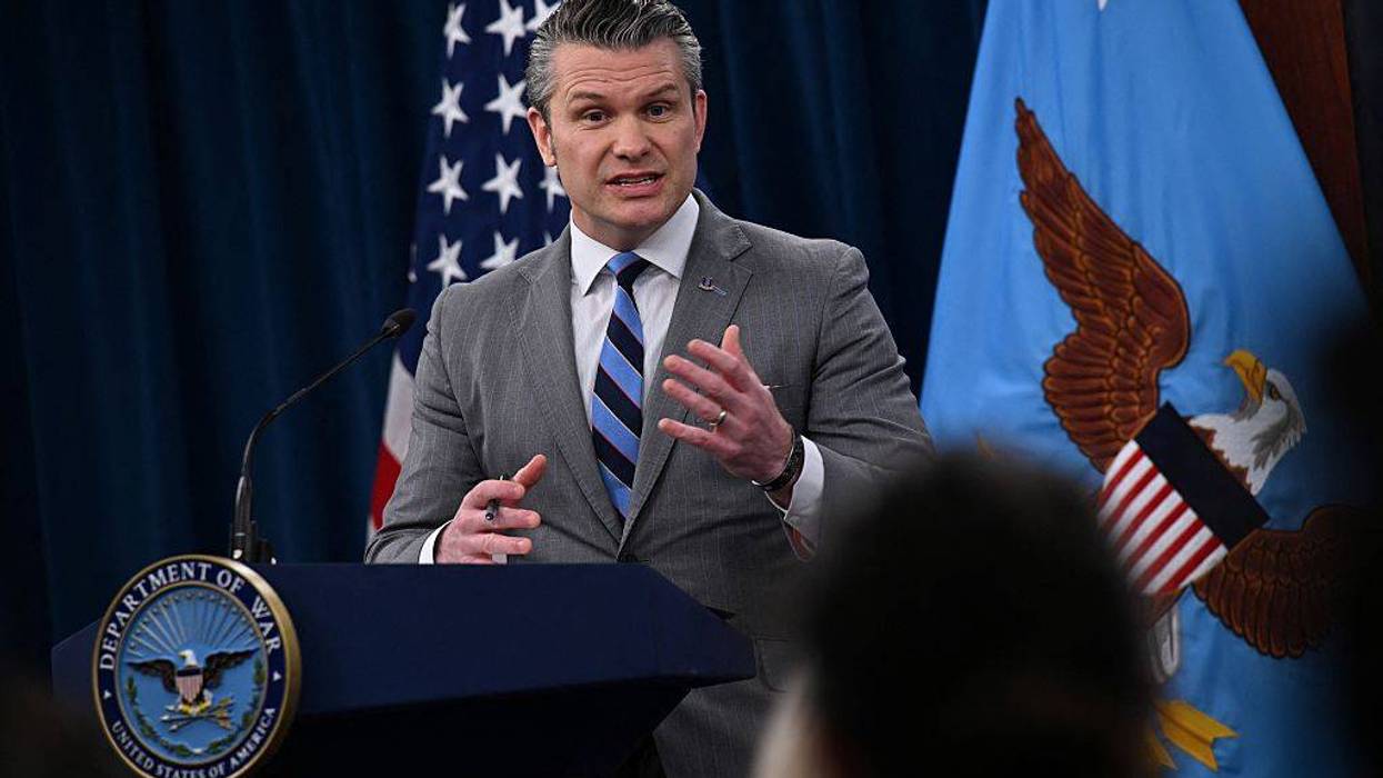
US Defense Secretary Pete Hegseth on Friday once again suggested the international community should show gratitude for President Donald Trump's illegal war with Iran, which has led to a global oil supply shock and created the potential for food shortages in the coming months.
Speaking with reporters at the Pentagon, Hegseth defended the president's decision to launch a war of choice with Iran that so far has cost US taxpayers an estimated $60 billion.
"It's a bold and dangerous mission," said Hegseth. "A gift to the world. Historic. Courtesy of a bold and historic president."
Hegseth: "It's a bold and dangerous mission. A gift to the world. Historic. Courtesy of a bold and historic president." pic.twitter.com/AR0zs6Djd4
— Aaron Rupar (@atrupar) April 24, 2026
Hegseth also chided US allies for not getting involved in the war, which Trump and Israeli Prime Minister Benjamin Netanyahu launched in late February without any consultation or coordination with Europe.
"America and the free world deserve allies who are capable, who are loyal, and who understand being an ally is not a one-way street," he said. "We are not counting on Europe, but they need the Strait of Hormuz much more than we do, and might want to start doing less talking and having less fancy conferences in Europe, and get in a boat. This is much more their fight than ours."
Hegseth: "We are not counting on Europe, but they need the Strait of Hormuz much more than we do, and might want to start doing less talking and having less fancy conferences in Europe and get in a boat. This is much more their fight than ours." pic.twitter.com/OUnt3n9TfV
— Aaron Rupar (@atrupar) April 24, 2026
In reality, there is little reason for the world to feel gratitude to the US and Israel for the war.
As reported by Barron's on Friday, the war has created a global shortage of jet fuel that has led to airlines canceling flights, with Europe being particularly hard hit.
German airline Lufthansa, for instance, has announced it's cutting 20,000 flights through October, and even US airlines such as Delta have been announcing cuts to save money thanks to the increase in jet fuel prices.
South China Morning Post reported on Wednesday that Asian nations are bracing for food shortages, as the Iran War has led to a shortage of fertilizer for crops during the planting season throughout much of the world.
In addition to citing the effects of the Iran War on global food supplies, the South China Morning Post pointed to scientists' warnings of a "super El Niño" that could lead to lower than average rainfall.
“It is very concerning because this year is supposed to be a super El Niño, and you are getting into the planting season,” Gnanasekar Thiagarajan, founder of India-based financial research and advisory firm Commtrendz Research, told South China Morning Post. "This is going to be widespread across South and Southeast Asia. There will be dryness everywhere."
Jorge Moreira da Silva, executive director of the United Nations Office for Project Services (UNOPS), warned on Tuesday that there is a real risk of a global food crisis if the Strait of Hormuz remains closed to shipments of fertilizer.
“The planting season has already started, and in most countries in Africa it will end in May," the UN official explained. "So, if we don’t get some solution immediately, the crisis will be very significant and severe, particularly for the poorest countries and for the poorest citizens."
"It's the first time in history that it's more likely than not that we will exceed 1.5°C," said a co-author of a new U.N. report.
Naturally-occurring El Niño events have resulted in hotter global temperatures for thousands of years, but a United Nations agency warned Tuesday that the warming trend that scientists expect to form in the coming months will be intensified by heat-trapping greenhouse gas emissions—likely resulting in an average global temperature that's more than 1.5°C above pre-industrial levels for at least a year.
"A warming El Niño is expected to develop in the coming months and this will combine with human-induced climate change to push global temperatures into uncharted territory," said Prof. Petteri Taalas, secretary-general of the World Meteorological Organization (WMO), as the agency released its Global Annual to Decadal Climate Update ahead of the El Niño Southern Oscillation (ENSO) event.
A global average temperature that exceeds 1.5°C above pre-industrial levels would mean that the planet temporarily grows hotter than the limit specified by the Paris climate agreement.
The WMO report says there is a 66% chance that the annual average global temperature will exceed 1.5°C above pre-industrial levels for at least one year between 2023 and 2027.
"It's the first time in history that it's more likely than not that we will exceed 1.5°C," Adam Scaife of the U.K.'s Met Office, who worked on the report, told Reuters.
As Common Dreams reported Monday, climate scientists are currently observing trends in the Pacific Ocean that appear "very much like the 1997 and 2015 early stages of a Super El Niño," in which very high temperatures would be recorded near the equator.
El Niño events occur roughly every five years, and the one that appears to be forming now is likely to make at least one of the next five years the warmest on record. The El Niño event that occurred in 2016 contributed to 2016, 2019, and 2020 being the hottest years on record so far.
The WMO report said there is a 98% chance that the upcoming five-year period as a whole will be the warmest in recorded history. There is a 32% likelihood that the five-year mean temperature will exceed the 1.5°C threshold.
Although the breach of the 1.5°C limit is expected to be temporary, Taalas warned that this El Niño event could signal a new pattern.
"This report does not mean that we will permanently exceed the 1.5°C level specified in the Paris Agreement which refers to long-term warming over many years. However, WMO is sounding the alarm that we will breach the 1.5°C level on a temporary basis with increasing frequency,” said Taalas. "This will have far-reaching repercussions for health, food security, water management, and the environment. We need to be prepared."
Scientists and heat experts have begun calling on officials to prepare communities with cooling stations, access to air conditioning equipment, and other measures to cope with the hot weather El Niño is expected to bring.
Prior to 2015, the chance of the annual global average temperature crossing the 1.5°C threshold was "close to zero," according to the WMO. Between 2017 and 2021, scientists recorded a 10% chance.
"Global mean temperatures are predicted to continue increasing, moving us away further and further away from the climate we are used to," said Dr. Leon Hermanson, a Met Office scientist who led the report.
The report noted that warming in the Arctic is "disproportionately high," which has threatened the collapse of a crucial ocean current system and disrupted weather patterns in the northern hemisphere.
Climate writer Andy Rowell called the WMO's report both "heartbreakingly terrifying and predictable" as the fossil fuel industry and policymakers refuse to heed the warnings of scientists and energy experts, who say the continued extraction of oil and gas have no place on a pathway to avoiding the 1.5°C warming limit.
"This is the time to direct our energies and efforts toward preparedness and readiness, particularly to protect our most vulnerable citizens from the impact of extreme heat," said one expert.
With scientists pointing to a number of weather patterns this year that have already signified that the El Niño Southern Oscillation may amplify planetary heating in the coming months, one heat and public health expert said Monday that officials must take advantage of the time they have now to prepare their communities for potential extreme heat events in the United States and around the world.
"We will likely see a significant impact from El Niño in the 2023 heat season," said Ashley Ward, a senior policy associate at Duke University's Nicholas Institute for Energy, Environment & Sustainability. "While El Niño is still forming this year, we need to prepare for the 2024 heat season to likely be worse."
Ward said the last time scientists observed the kind of significant heat caused by El Niño that they're expecting to see this year was in 2016, which is tied with 2020 for the hottest year on record.
As climate researcher Leon Simons said last week regarding current ocean warming trends, scientists are currently observing heat patterns that look "very much like the 1997 and 2015 early stages of a Super El Niño," which is marked by very high temperatures in the Pacific Ocean near the equator.
"Based on the year-to-date and the current El Niño forecast," wrote Zeke Hausfather at Carbon Brief late last month, "2023 is very likely to end up between the warmest year on record and the sixth warmest, with a best estimate of fourth warmest."
Ward called on officials at the state and local level to take the next several weeks to "develop response plans for periods of extreme heat that address how to reach both urban and rural populations."
"This is the time to direct our energies and efforts toward preparedness and readiness, particularly to protect our most vulnerable citizens from the impact of extreme heat," said Ward.
Extreme heat has devastated parts of the world, including the U.S., in recent years.
Temperature records were broken in Vietnam and Laos last week, with the northern district of Tuong Duong recording a high of 111.6°F. Record-shattering heat in the Pacific Northwest was linked to hundreds of deaths in 2021, and more than 1,000 people died in Western Europe last summer of heat-related causes.
Ward said public health and safety authorities should begin organizing educational campaigns to "help individuals understand how they can mitigate heat" and to examine how they can help people procure fans and other cooling devices.
"Additional measures could include... providing shelter for the unhoused during periods of extreme heat," said Ward, "and reinforcing heat safety guidelines for occupational exposure and student-athletes."
NASA this weekend released new data which shows that February 2016 was not only the hottest in recorded history, but it soared past all previous records, prompting scientists to describe the announcement as "an ominous milestone in our march toward an ever-warmer planet."
The average global surface temperature for February was 1.35degC warmer than the global average for the month between 1951-1980--a margin that shattered the previous record of 1.14degC, which was set just one month earlier--and exceeded preliminary figures released earlier this month.
"NASA dropped a bombshell of a climate report," wrote meteorologists Bob Henson and Dr. Jeff Masters, founder of the Weather Underground. "February 2016 has soared past all rivals as the warmest seasonally adjusted month in more than a century of global record keeping."
February's new temperature record beat that set in January 2016 by a full 0.21degC, which Masters and Henson described as "an extraordinary margin."
"We are in a kind of climate emergency now."
--Stefan Rahmstorf, Potsdam Institute of Climate Impact Research
Scientists are normally wary of highlighting a single month's temperature spike, particularly in an El Nino cycle. However, this record bests even the one set during the Super El Nino of February 1998 by 0.47degC.
Stefan Rahmstorf, from Germany's Potsdam Institute of Climate Impact Research and a visiting professorial fellow at the University of New South Wales, told the Sydney Morning Herald that the new figures are "quite stunning ... it's completely unprecedented."
And given the increasing concentration of carbon in the global atmosphere, which is driving higher long-term temperature increases as well as other extreme weather events, the string of monthly records is a foreboding sign.
Henson and Masters explain:
The real significance of the February record is in its departure from the seasonal norms that people, plants, animals, and the Earth system are accustomed to dealing with at a given time of year. Drawing from NASA's graph of long-term temperature trends, if we add 0.2degC as a conservative estimate of the amount of human-produced warming that occurred between the late 1800s and 1951-1980, then the February result winds up at 1.55degC above average. If we use 0.4degC as a higher-end estimate, then February sits at 1.75degC above average. Either way, this result is a true shocker, and yet another reminder of the incessant long-term rise in global temperature resulting from human-produced greenhouse gases.
They conclude, "we are now hurtling at a frightening pace toward the globally agreed maximum of 2.0degC warming over pre-industrial levels."
And Rahmstorf also notes, "We are in a kind of climate emergency now."
As many as 50 million people across the world face potential hunger, disease, and water shortages by early 2016 if countries do not act immediately, declared Oxfam International on Monday, addressing those nations predicted to be ravaged by this year's Super El Nino as well as wealthy governments indebted to those most vulnerable to climate change.
"The warning bells are deafening," said Meg Quartermaine, humanitarian manager with Oxfam Australia, which issued the warning on the same day that the powerful Typhoon Melor made landfall in the Philippines, forcing the evacuation of 725,000 people.
The Philippines is among the countries that the global anti-poverty group has previously identified as having a food supply already threatened by the impacts of climate change. The typhoons and other extreme weather events that are being predicted under, what could be "the most powerful El Nino on record" are expected to drive millions of people in the Pacific rim region, and across the globe, into even more dire straits.
Monday's report (pdf) said that Papua New Guinea will likely bear the brunt of this season's "super charged weather phenomenon," with the country's National Disaster Committee estimating that as many as 3 million people are at risk of starvation, "as crop failures force many people to cut back to eating just one meal a day."
While that nation--along with Vanuatu, Fiji, the Solomon Islands, Samoa, and Tonga--are "experiencing worsening drought, central Pacific countries like Kiribati and Tuvalu will likely see intense rain causing flooding and higher sea levels," the report states.
What's more, the warning comes on top of a recent scientific study which found that heightened greenhouse gas emissions will likely exacerbate the naturally-occurring El Nino phenomenon and drive global temperatures to record highs.
The stark report comes just days after global leaders adopted the landmark Paris Agreement in an effort to stem the growing crisis of climate change. While the COP21 pact made strides in limiting countries' greenhouse gas emissions and capitulated to the demands of small island nations to limit warming to 1.5degC, it failed to hold the world's richest and most polluting nations accountable for their outsized role in driving the global emergency.
"This is a wake-up call for those on the way home from the UN climate conference," Quartermaine said of the Oxfam report. "Emissions targets must be rapidly strengthened if we are to ensure the goal of limiting warming to below 2degC or 1.5degC can be met. And more funding is required for vulnerable communities to adapt to increasingly unpredictable and extreme weather."
The group commends the Australian government for committing $9 million to support Papua New Guinea and other countries in the Pacific in order to prepare for and mitigate the effects of El Nino. However, Quartermaine adds that "it is clear that much more will be needed over coming months as the impacts of this potentially unprecedented El Nino event become greater."
"This is a crisis on a huge global scale," she adds.