SUBSCRIBE TO OUR FREE NEWSLETTER
Daily news & progressive opinion—funded by the people, not the corporations—delivered straight to your inbox.
5
#000000
#FFFFFF
To donate by check, phone, or other method, see our More Ways to Give page.
A new website by writer and technologist James Bridle shines an important spotlight on some of the "names of places most of us will never see." By using images from Google earth and target details from the Bureau of Investigative Journalism, he identifies the "towns, villages, junctions and roads" that have been targets of drone attacks.
The London-based designer writes on his blog, booktwo.org, that he wanted to make this augmented form of 'death-dealing' "just a little bit more visible, a little closer. A little more real."
Bridle continues:
The political and practical possibilities of drone strikes are the consequence of invisible, distancing technologies, and a technologically-disengaged media and society. Foreign wars and foreign bodies have always counted for less, but the technology that was supposed to bring us closer together is used to obscure and obfuscate. We use military technologies like GPS and Kinect for work and play; they continue to be used militarily to maim and kill, ever further away and ever less visibly.
This summer, Apple rejected an iPhone app that similarly sent users notification whenever a drone strike occured, on the basis that the content was "objectionable and crude."
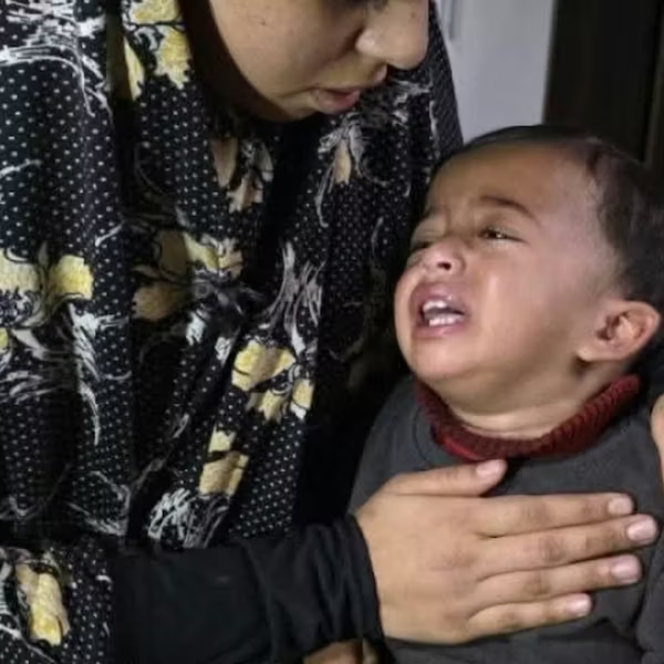
According to the Bureau of Investigative Journalism, the US has killed up to 3,378 people in 350 drone strikes in the past eight years in Pakistan alone. Other campaigns persist in Yemen and countries in northern Africa.
Bridle hopes that the immediacy and intimacy of these seemingly benign "landscapes" will add to the growing demand for transparency. You can follow Dronestagram on Tumblr, Instagram and Twitter.
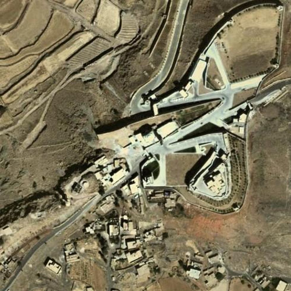
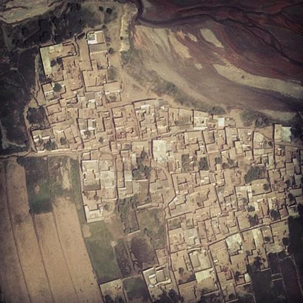
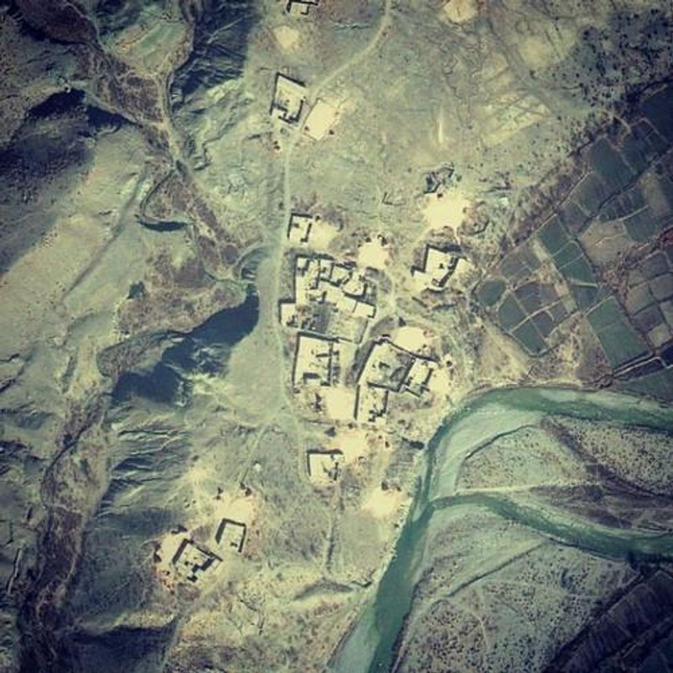
A new website by writer and technologist James Bridle shines an important spotlight on some of the "names of places most of us will never see." By using images from Google earth and target details from the Bureau of Investigative Journalism, he identifies the "towns, villages, junctions and roads" that have been targets of drone attacks.
The London-based designer writes on his blog, booktwo.org, that he wanted to make this augmented form of 'death-dealing' "just a little bit more visible, a little closer. A little more real."
Bridle continues:
The political and practical possibilities of drone strikes are the consequence of invisible, distancing technologies, and a technologically-disengaged media and society. Foreign wars and foreign bodies have always counted for less, but the technology that was supposed to bring us closer together is used to obscure and obfuscate. We use military technologies like GPS and Kinect for work and play; they continue to be used militarily to maim and kill, ever further away and ever less visibly.
This summer, Apple rejected an iPhone app that similarly sent users notification whenever a drone strike occured, on the basis that the content was "objectionable and crude."
According to the Bureau of Investigative Journalism, the US has killed up to 3,378 people in 350 drone strikes in the past eight years in Pakistan alone. Other campaigns persist in Yemen and countries in northern Africa.
Bridle hopes that the immediacy and intimacy of these seemingly benign "landscapes" will add to the growing demand for transparency. You can follow Dronestagram on Tumblr, Instagram and Twitter.