
5
#000000
#FFFFFF
To donate by check, phone, or other method, see our More Ways to Give page.



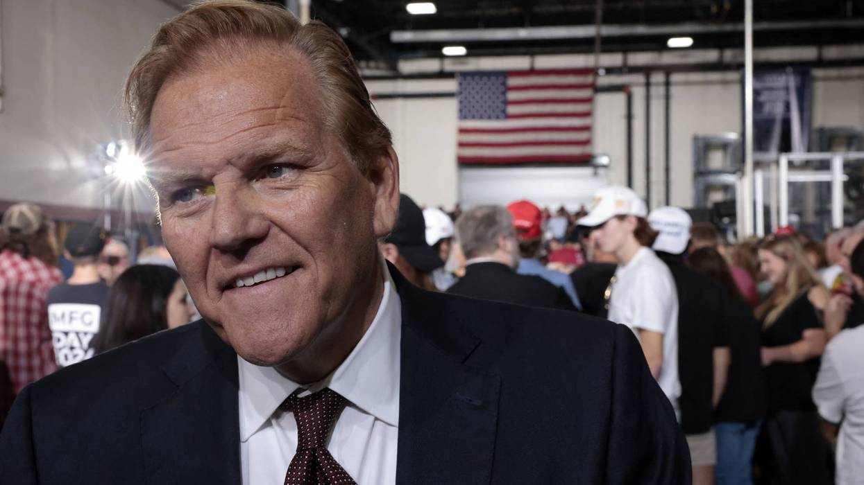


Two years ago, Michigan Republican Mike Rogers stood in a grocery store for an advertisement blaming Joe Biden for the price of eggs (without mentioning the bird flu that was jacking prices). This week he’s back in nearly the same folksy jacket telling voters that it’s time for Trump to end his illegal war against Iran so gas prices can come down.
Rogers new ad leaves out, of course, the fact that he’d cheered for the war on the day it began in February, claiming Iran was an imminent threat to the United States (it wasn’t and isn’t), and hit multiple rightwing podcasts and media opportunities to demand Americans unite behind Trump in prosecuting the war.
He’s not alone. Just last week, Iowa Republican Ashley Hinson voted to keep the war going — after voting six times previously to support Trump and his war — but a few days ago cut a desperate ad calling for a swift end to the fighting.
Iowa Republicans Zach Nunn and Mariannette Miller-Meeks, both in tight House races, suddenly discovered the War Powers Act and joined Democrats to limit the president they’d been backing. Down in Florida, Republican Rep. Maria Elvira Salazar released an ad warning that Miller’s brutal masked goons have gone too far and that Hispanic voters now feel betrayed.
Americans have noticed who lit these particular fires. A New York Times/Siena poll this month found 50 percent of registered voters trust Democrats over Republicans to handle foreign wars, and GOP whackadoodle Nancy Mace, on her way out of Congress, told reporters she’s expecting a “bloodbath” at the polls this November.
Trump himself, asked on Meet the Press how a seven-month war squares with two campaigns with hundreds of promises of no new wars, answered that he “didn’t promise anything” and stormed out of the interview like a petulant 10-year-old.
This is just the latest in a 45-year-long Republican scam where they break something in America, blame it on the Democrats, and then run for election on a promise to fix what they broke.
Probably their most successful of these scams since the Clinton years has been to invite non-citizens from south of the border to come into the US whenever a Democrat is in the White House, falsely claiming that the Democrat had “opened the border.” This lie, of course, encourages desperate people to head north and that gives the GOP and their media operations the photo-op they need.
Just google “open border” and “congressman,” “congresswoman,” or “senator” and you’ll get a list of Republican politicians too long to print. These are the quotes that coyotes — human smugglers — print out and distribute to desperate people in Central and South America as advertisements to get people to trade their lives’ savings for transportation to the Rio Grande.
Not one single Democratic president ever “opened” the border or declared it open. It’s a complete lie, top to bottom, that Republicans and billionaire-owned media repeat obsessively.
Obama, in fact, deported more people than Trump did in his first term. But Republicans still use that lie to roll out the red carpet to wannabe immigrants.
At the top of that list of Republicans lying about Democrats “opening the border,” of course, you’ll find the most contemptible Republican demagogues cranking this stuff out during the last two years of Biden’s presidency so they could use the immigrant issue to get Trump back into the White House in 2024. Here’s a tiny sample from the months leading up to recent elections:
— Ted Cruz wants everybody south of our border to know that the “Biden Open Border Policy [is] A Very Craven Political Decision”;
— Rick Scott wants everybody to know that “Americans Don’t Want [Biden’s] Open Borders”;
— Marco Rubio says there’s “Nothing Compassionate About Biden’s Open Border Policies”;
— Rand Paul is so extreme he tells us Senator Rubio “is the one for an open border”;
— Josh Hawley says “Biden’s Open Border Policy Has Created a Moral Crisis”;
— Tom Cotton “Insists the Border is Wide Open”;
— Ron Johnson wants the world to know that “Our National Security is at Risk Because Democrats have Turned Border Security into a Partisan Issue”;
— Marjorie Taylor Greene “BLASTS Open Border Hypocrites”;
— Mo Brooks opposes “Socialist Democrats’ Open Border Policies for Helping Kill Americans”;
— Lauren Boebert says the “Root Cause” of the open border crisis “is in the White House”;
— Matt Gaetz “revealed a complex and deceitful agenda by Joe Biden’s Democrat administration to evade our Southern Border law enforcement”;
— Gym Jordan says “Biden’s Deliberate Support of Illegal Immigration Could Lead to Impeachment”;
— Kevin McCarthy says the Biden Administration has “Utterly Failed” to secure the “open border”;
— Elise Stefanik proclaims “Biden’s Open Border Policies have been a Complete Disaster.”
— Tom Cole’s website features “Biden’s Open Border America”;
— Bob Goode brags about introducing legislation named the “Close Biden’s Open Border Act”;
— John Rose “Calls Out Biden’s Open Border Policies”;
— Paul Gosar claims Biden is “Destroying America with His Open Border Policies”;
— Roger Williams complains about the “Democrats’ Open Border Problem”;
— Tom Cole wants the world to know that Biden’s “open border policies have given the green light to migrants and bad actors from around the world…”;
— Gus Bilirakis “Denounces Dangerous Open Border Policies on the House Floor”;
The list goes on and on, every single one from a Republican.
And these messages have spread all across Central and South America, just as Republicans hoped they would, driven by human smugglers following the profit motive.
All based on an intentional Republican campaign lie that has worked well for them since they first used it on Clinton in the 1990s.
And here we go again, although this time Marjorie Taylor Greene called bullshit on her former colleagues.
Last Thursday, around 400 Hondurans — families with kids among them — crossed a bridge from Guatemala into Chiapas, Mexico on foot. Rightwing influencers, knowing the drill, immediately began to promote this new coming “invasion.” PJ Media ran the story under a headline that literally tied the caravan to a coming Democratic Congress.
Marjorie Taylor Greene was having none of it, though, writing on social media:
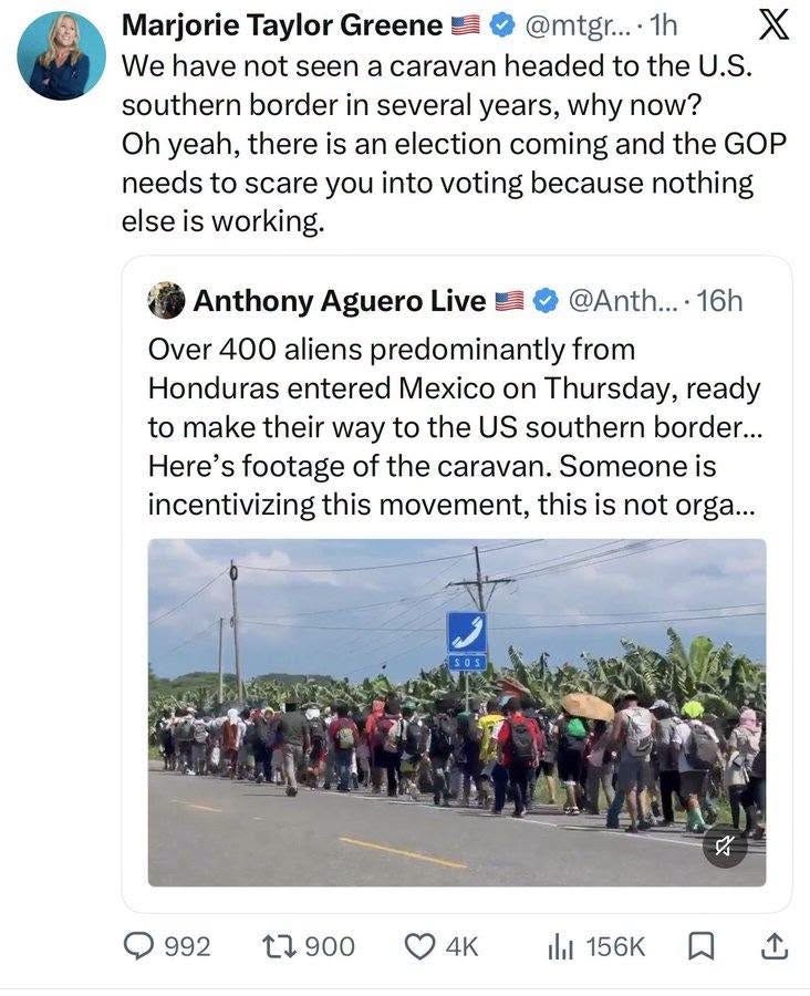
“We have not seen a caravan headed to the US southern border in several years, why now? Oh, yeah, there is an election coming and the GOP needs to scare you into voting because nothing else is working.”
Yep, it’s an old scam but an effective one. Essentially, what Republicans have been doing — since Reagan first told us government was our problem and he’d take care of ruining it for us — is to smash out our windows and then offer to sell us homeowners’ insurance.
It’s a hustle. Just like “trickle down.” And “small government,” “waste, fraud, and abuse,” “guns keep us safe,” “global warming is a hoax,” and “originalism.”
Greene would know. In October 2018, two weeks before the midterms the last time he was president, she cheered when Trump declared a caravan a thousand miles from Texas an “invasion,” ordered a showy force of 5,200 troops to the border, and told Republicans that it’d be a great midterm issue for them.
In the seven days before Election Day that year Fox News used the word “caravan” 1,202 times.
In an astonishing display of transparent cynicism, the Pentagon dropped the operation’s patriotic name the morning after the polls closed, and the troops were going home two weeks later. All the panic vanished the day after the election, weeks before most of the migrants got anywhere near our border.
Then in 2024, with Biden in the White House, Republicans demanded an immigration/border bill, got the most conservative one in a generation from their own senator, James Lankford, and then were forced to kill it because Trump wanted to crank up his racist base with fears of brown-skinned hordes on the march to regain the White House.
That’s the entire Republican business model, and it’s older than Trump. Republicans manufacture the fear, or the crisis, or the deficit, and then campaign as the only people who can protect you from it. The “product” never has to work, because fear is their real product and has been since the days of Joe McCarthy.
Ronald Reagan set it up in its modern form. In 1976 Jude Wanniski, a Wall Street Journal editorial writer, told Republican insiders they’d never win as the party of Scrooge and should instead become a second Santa Claus, handing out tax cuts as freely as Democrats handed out programs, then screaming about the debt the moment a Democrat took office.
Reagan cut the top income tax rate from 70 percent to 28, tripled the national debt, and sold it with a promise of prosperity for everybody. Republicans (and Reagan) knew it was a lie; his former budget director, David Stockman, admitted as much in The Atlantic before Reagan’s first term was half over.
And now that scam has transferred almost $80 trillion from working people into the money bins of the top 1 percent, gutting the middle class, and Republicans are still pitching billionaire tax cuts as the cure for all our ills.
Then there’s the destruction of America’s small businesses so big business fatcats would back the GOP. Reagan’s Justice Department rewrote the merger guidelines in 1982 and the share of proposed mergers the government challenged fell to seven-tenths of one percent, which is how we ended up with a small handful of companies controlling our grocery chains, hospital systems, airlines, insurance, banking, drugs, retail, and even the oil companies that Rogers is now complaining about in his bizarre new ads.
And let’s not forget freezing the wages of workers, as I mentioned here last week. Reagan fired the air traffic controllers and union membership fell from about a third of our workforce when he took office to under a tenth today, and every Republican since has campaigned on pretending to be in favor of raising your pay while, with their other hand behind their back, voting in Congress to freeze the minimum wage and make it harder for people to form or join a union.
Once they’d gotten away with these scams and still gotten elected (with the help of billionaire-owned media), governing by scam became the GOP’s go-to habit.
They’ve kept the federal minimum wage frozen at $7.25 since 2009 and are running this fall on “affordability.”
They passed a “Big Beautiful” bill last summer that the Congressional Budget Office says will add $3.4 trillion to our debt, knock 10 million people off their health insurance, and cut more than a trillion dollars from Medicaid and food assistance.
And, the CBO found, the result is (predictably) that resources will decrease for households at the bottom while rising for those at the top. Four million fewer people are getting SNAP already, because of that bill. And you can bet your bottom dollar that when this really bites over the next two years Republicans will be blaming Democrats and offering to fix the problems that they themselves created.
Then Trump began throwing around tariffs, particularly against countries he wanted to give him gifts, jets, or business deals for Uday and Qusay, all while cynically pretended it’d bring manufacturing back to the US and raise wages.
Republicans have, in other words, spent the past forty-five years telling us our “big” government is the problem while expanding its reach into your doctor’s office, your ballot, and now your constitutional right to walk down the street without getting shot by ICE thugs or having to show your citizenship papers to a masked man who refuses to identify himself.
Each of these moves was sold as a rescue from a problem the Republicans themselves had created, vibrating with urgency in the last few weeks before an election.
What’s different this year is that the timing has blown up in their faces.
When a war hawk like Rogers, whose own former primary opponent Justin Amash says he’s losing badly, goes soft on a war he championed, or when a sitting president says he never promised the thing his rallies chanted for two years, people can suddenly see the scam in the plain light of day. Even the caravan, the oldest trick in the book, drew a former MAGA congresswoman outing this strategy to her own followers.
Reagan got a laugh in 1986 by saying the nine most terrifying words in the English language were “I’m from the government and I’m here to help.” Forty-five years and the DOGE gutting of FEMA on, nobody’s laughing except the Republicans who keep getting elected by low-information voters hooked on billionaire-owned media.
The simple reality — that previous generations understood well — is that government is the only institution with the power to lay a floor beneath which working people and the poor can’t fall, whether that floor is a wage, a pension, an education, a hospital bed, or a border policy that’s actually enforced instead of advertised.
Republicans have spent four decades pulling up the floorboards and then charging admission to watch people fall through. This November they’re asking to be paid again to fix the problems they themselves created. The polls, however, are telling us that even formerly Republican voters have finally figured out the con.
So check your registration at vote.org, because the caravan story will be replaced by another outrageous panic next week (trans people? Iran strikes back at us in a 9/11 style? the “caravan” arrives?) and the only thing that beats a fear campaign is turnout.
And if this piece helped you see the pattern, please share it and support the Hartmann Report so we can keep pulling these threads and exposing these cons.