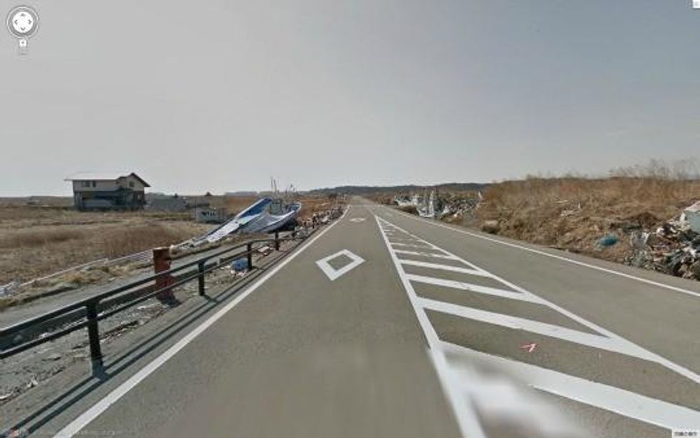
A deserted town within the area most affected by the
Fukushima nuclear disaster of 2011
can now be seen up close via the online mapping service Google Street View, featured in Google maps.
Through the technology, one can now take a virtual stroll down the devastated and largely deserted streets of a once active seaside community, the city of Namie.
Namie was formerly home to 21,000 residents who have been unable to return since the disaster two years ago.
The streets remain mostly empty, barring rubble and litter left behind, a testament to the vast dangers of the nuclear industry.
"Those of us in the older generation feel that we received this town from our forbearers, and we feel great pain that we cannot pass it down to our children," Namie Mayor Tamotsu Baba said.
"We want this Street View imagery to become a permanent record of what happened to Namie-machi in the earthquake, tsunami and nuclear disaster."
Google has been documenting the damage from the disaster over the past two years on the site, "Mirai e no kioku" --"memories for the future" -- with Street View footage of several cities surrounding Fukushima from before and after the tsunami.
[iframe https://maps.google.com/maps?q=%E8%AB%8B%E6%88%B8%E6%BC%81%E6%B8%AF,+Namie,+Fukushima+Prefecture,+Japan&hl=ja&ie=UTF8&sll=37.0625,-95.677068&sspn=38.775203,75.9375&oq=%E8%AB%8B%E6%88%B8&hq=%E8%AB%8B%E6%88%B8%E6%BC%81%E6%B8%AF,&hnear=%E6%97%A5%E6%9C%AC,+%E7%A6%8F%E5%B3%B6%E7%9C%8C%E5%8F%8C%E8%91%89%E9%83%A1%E6%B5%AA%E6%B1%9F%E7%94%BA&t=m&layer=c&cbll=37.484227,141.030021&panoid=B5J2mSWdnESMG_EO4l28pg&cbp=13,170.52,,0,0.21≪=37.481167,141.030035&spn=0.010693,0.024118&z=15&source=embed&output=svembed height=314 width=460]
_______________________


