

SUBSCRIBE TO OUR FREE NEWSLETTER
Daily news & progressive opinion—funded by the people, not the corporations—delivered straight to your inbox.
5
#000000
#FFFFFF
To donate by check, phone, or other method, see our More Ways to Give page.


Daily news & progressive opinion—funded by the people, not the corporations—delivered straight to your inbox.
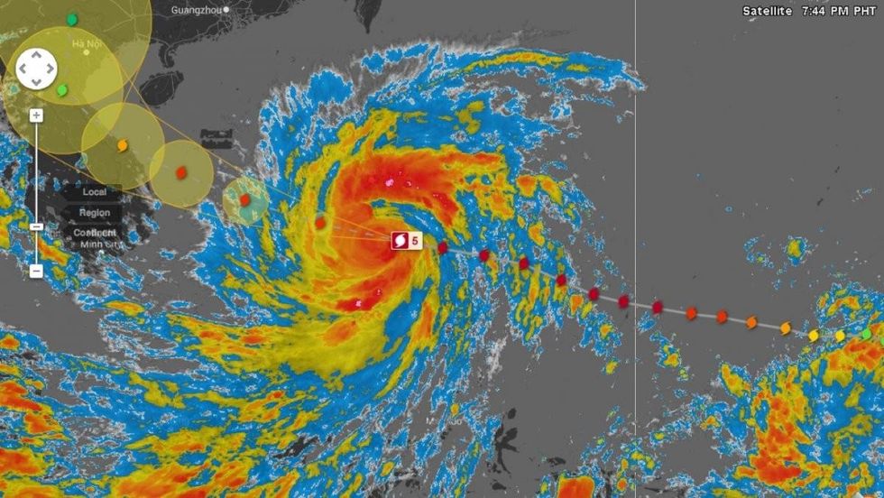
Super Typhoon Haiyan slammed the central islands of the Phillipines overnight and with sustained winds of nearly 200 mph the ferocious storm fulfilled fears that it would go down as the world's most powerful tropical storm to make landfall in all recorded history.
According to meteorologist Jeff Masters, citing wind speed estimates from the Joint Typhoon Warning Center (JTWC, "Haiyan had winds of 190-195 mph at landfall, making it the strongest tropical cyclone on record to make landfall in world history. The previous record was held by the Atlantic's Hurricane Camille of 1969, which made landfall in Mississippi with 190 mph winds."
Three people have been reported killed by the storm as of Friday morning, but that number is expected to rise. Tens of thousands were evacuated and the World Food Programme has warned that as many as 2.5 million people will need emergency assistance in the storm's wake.
Giant waves, over fifteen feet in some places, were reporting as Haiyan came ashore but it was the wind strength that was cited as the most destructive aspect of the storm. As communication systems are down in the hardest hit areas, damage reports from those places were so far hard to come by.
As the Guardian reports:
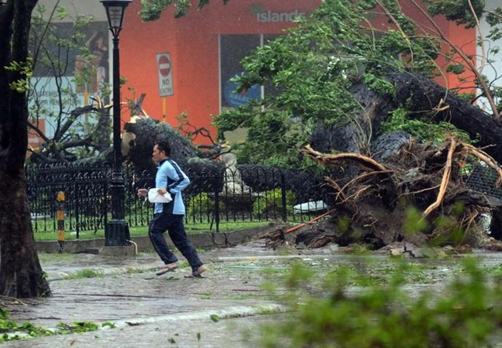
The storm - which is dubbed Yolanda in the Philippines - ripped iron roofs off buildings and threw trees across roads, cutting out power to entire provinces, particularly around the storm's centre in Eastern Samar province.
"We've been hearing from my colleagues in [the city of] Tacloban that they've seen galvanised iron sheets flying just like kites," Mai Zamora, of the charity World Vision, told the BBC. "It's actually all around the roads now. The roads are flooded in Tacloban."
Having now passed over the Phillipines, the storm is regaining some lost strength as it crosses the South China Sea and heads for Vietnam, Laos, and mainland China.
Twitter continues to track updates from users around the globe:
And Simon Redfern, a professor of Earth sciences at Cambridge, puts the megastorm in the context of climate change and the broader trend of extreme weather patterns that have been tied to global warming. Writing for the online journal The Conversation, he explains:
The surface water, as well as deeper water, temperatures of the Western Pacific have provided huge amounts of energy for the storm to absorb, fuelling Haiyan's intensification.
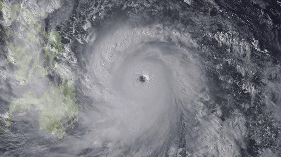
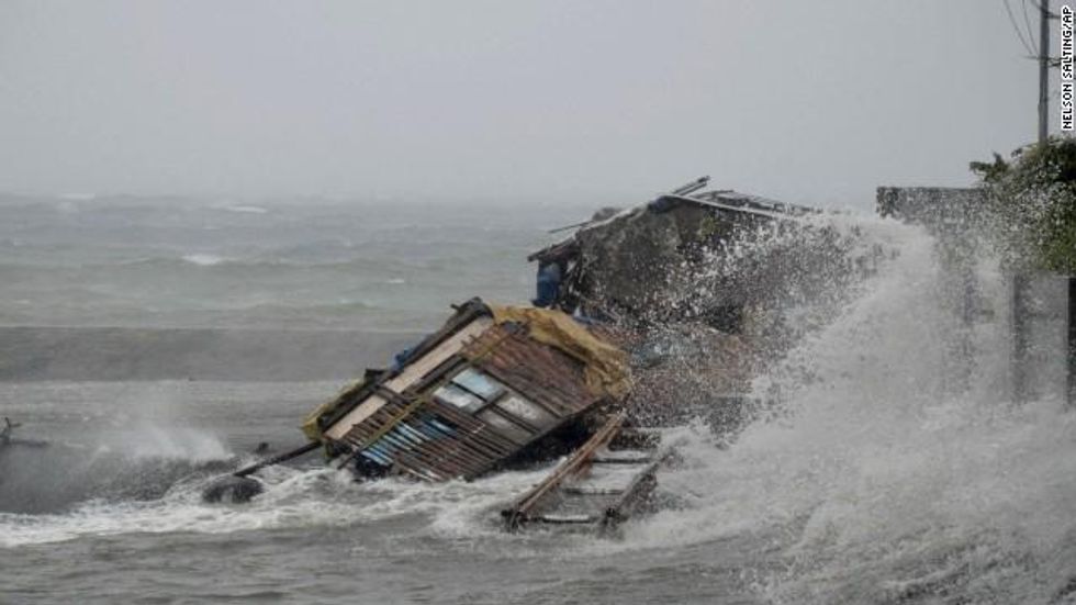
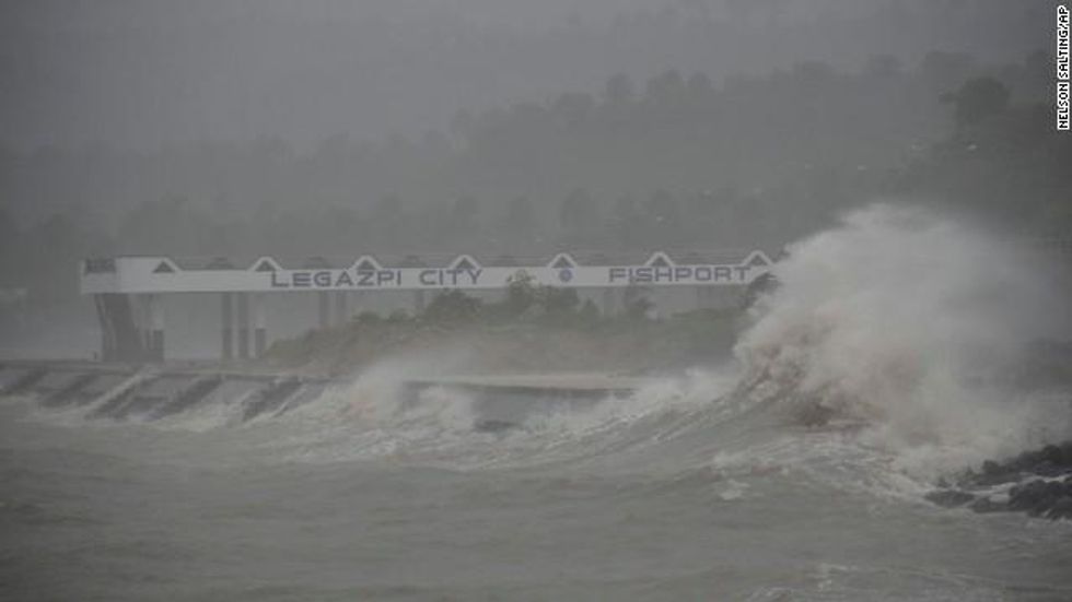
Super Typhoon Haiyan in pictures:
______________________________
Dear Common Dreams reader, The U.S. is on a fast track to authoritarianism like nothing I've ever seen. Meanwhile, corporate news outlets are utterly capitulating to Trump, twisting their coverage to avoid drawing his ire while lining up to stuff cash in his pockets. That's why I believe that Common Dreams is doing the best and most consequential reporting that we've ever done. Our small but mighty team is a progressive reporting powerhouse, covering the news every day that the corporate media never will. Our mission has always been simple: To inform. To inspire. And to ignite change for the common good. Now here's the key piece that I want all our readers to understand: None of this would be possible without your financial support. That's not just some fundraising cliche. It's the absolute and literal truth. We don't accept corporate advertising and never will. We don't have a paywall because we don't think people should be blocked from critical news based on their ability to pay. Everything we do is funded by the donations of readers like you. Will you donate now to help power the nonprofit, independent reporting of Common Dreams? Thank you for being a vital member of our community. Together, we can keep independent journalism alive when it’s needed most. - Craig Brown, Co-founder |

Super Typhoon Haiyan slammed the central islands of the Phillipines overnight and with sustained winds of nearly 200 mph the ferocious storm fulfilled fears that it would go down as the world's most powerful tropical storm to make landfall in all recorded history.
According to meteorologist Jeff Masters, citing wind speed estimates from the Joint Typhoon Warning Center (JTWC, "Haiyan had winds of 190-195 mph at landfall, making it the strongest tropical cyclone on record to make landfall in world history. The previous record was held by the Atlantic's Hurricane Camille of 1969, which made landfall in Mississippi with 190 mph winds."
Three people have been reported killed by the storm as of Friday morning, but that number is expected to rise. Tens of thousands were evacuated and the World Food Programme has warned that as many as 2.5 million people will need emergency assistance in the storm's wake.
Giant waves, over fifteen feet in some places, were reporting as Haiyan came ashore but it was the wind strength that was cited as the most destructive aspect of the storm. As communication systems are down in the hardest hit areas, damage reports from those places were so far hard to come by.
As the Guardian reports:
The storm - which is dubbed Yolanda in the Philippines - ripped iron roofs off buildings and threw trees across roads, cutting out power to entire provinces, particularly around the storm's centre in Eastern Samar province.
"We've been hearing from my colleagues in [the city of] Tacloban that they've seen galvanised iron sheets flying just like kites," Mai Zamora, of the charity World Vision, told the BBC. "It's actually all around the roads now. The roads are flooded in Tacloban."
Having now passed over the Phillipines, the storm is regaining some lost strength as it crosses the South China Sea and heads for Vietnam, Laos, and mainland China.
Twitter continues to track updates from users around the globe:
And Simon Redfern, a professor of Earth sciences at Cambridge, puts the megastorm in the context of climate change and the broader trend of extreme weather patterns that have been tied to global warming. Writing for the online journal The Conversation, he explains:
The surface water, as well as deeper water, temperatures of the Western Pacific have provided huge amounts of energy for the storm to absorb, fuelling Haiyan's intensification.
Super Typhoon Haiyan in pictures:


______________________________

Super Typhoon Haiyan slammed the central islands of the Phillipines overnight and with sustained winds of nearly 200 mph the ferocious storm fulfilled fears that it would go down as the world's most powerful tropical storm to make landfall in all recorded history.
According to meteorologist Jeff Masters, citing wind speed estimates from the Joint Typhoon Warning Center (JTWC, "Haiyan had winds of 190-195 mph at landfall, making it the strongest tropical cyclone on record to make landfall in world history. The previous record was held by the Atlantic's Hurricane Camille of 1969, which made landfall in Mississippi with 190 mph winds."
Three people have been reported killed by the storm as of Friday morning, but that number is expected to rise. Tens of thousands were evacuated and the World Food Programme has warned that as many as 2.5 million people will need emergency assistance in the storm's wake.
Giant waves, over fifteen feet in some places, were reporting as Haiyan came ashore but it was the wind strength that was cited as the most destructive aspect of the storm. As communication systems are down in the hardest hit areas, damage reports from those places were so far hard to come by.
As the Guardian reports:
The storm - which is dubbed Yolanda in the Philippines - ripped iron roofs off buildings and threw trees across roads, cutting out power to entire provinces, particularly around the storm's centre in Eastern Samar province.
"We've been hearing from my colleagues in [the city of] Tacloban that they've seen galvanised iron sheets flying just like kites," Mai Zamora, of the charity World Vision, told the BBC. "It's actually all around the roads now. The roads are flooded in Tacloban."
Having now passed over the Phillipines, the storm is regaining some lost strength as it crosses the South China Sea and heads for Vietnam, Laos, and mainland China.
Twitter continues to track updates from users around the globe:
And Simon Redfern, a professor of Earth sciences at Cambridge, puts the megastorm in the context of climate change and the broader trend of extreme weather patterns that have been tied to global warming. Writing for the online journal The Conversation, he explains:
The surface water, as well as deeper water, temperatures of the Western Pacific have provided huge amounts of energy for the storm to absorb, fuelling Haiyan's intensification.
Super Typhoon Haiyan in pictures:


______________________________