SUBSCRIBE TO OUR FREE NEWSLETTER
Daily news & progressive opinion—funded by the people, not the corporations—delivered straight to your inbox.
5
#000000
#FFFFFF
To donate by check, phone, or other method, see our More Ways to Give page.
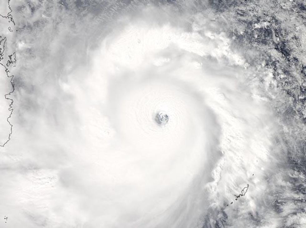
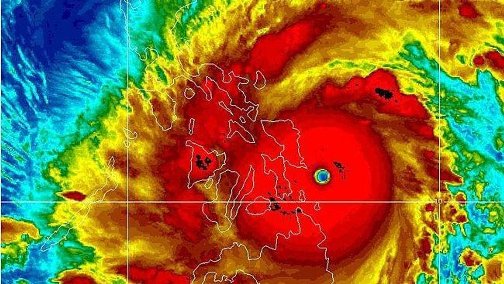
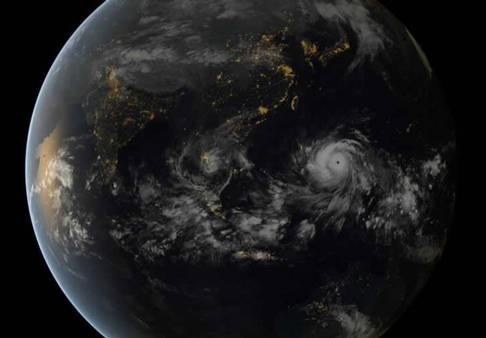
Super Typhoon Haiyan, known as Yolanda in the Philippines, has sustained winds of 195 mph with gusts up to 235 mph, according to recently updated data from the Joint Typhoon Warning Center.
Haiyan, the strongest storm in the world so far this year, "has the most spectacular appearance I've ever seen on satellite loops," writes Masters, "with a prominent eye surrounded by a huge, impenetrable-looking mass of intense eyewall thunderstorms with tops that reach into the lower stratosphere."
And the Washington Post reports, "The storm is now within a few hours of landfall in the central Philippines at peak intensity as among the most powerful storms witnessed anywhere in modern times. Widespread destruction, unfortunately, seems inevitable."
President Benigno S. Aquino III warned residents Thursday that they face a "calamity," issuing mass evacuation orders in a national TV address.
"Let me repeat myself: This is a very real danger, and we can mitigate and lessen its effects if we use the information available to prepare," he said.
The typhoon could make landfall early evening (EST) on Thursday, Friday morning local time, with reports coming in that it has already hit. (See Twitter feed below.)
Haiyan is likely to hit at Category 5 strength, the third typhoon in the category to hit the Philippines since 2010.
The most recent Category 5 storm to hit the Philippines was the catastrophic Super Typhoon Bopha on December 3, 2012, which killed 1901 people and caused up to at $1.7 billion in damages.
"We don't have any measurements of Haiyan's central pressure, but it may be close to the all-time record of 870 mb set by Super Typhoon Tip [in 1979]," Masters reports.
AccuWeather adds:
The expected track of Haiyan will take it directly over the areas hardest hit by a powerful 7.1 magnitude earthquake that killed more than 150 people in the middle of October.
Haiyan will also produce a severe and inundating storm surge, especially along the eastern coast of southern Luzon and Samar islands.
Due to the heavy rains and high winds, severe flooding is expected.
____________________