Report: Global Warming Could Double US Flooding
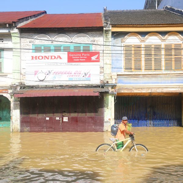
Rising seas dramatically increase the odds of damaging floods from storm surges. Global warming has raised global sea level about 8 inches since 1880, and the rate of rise is accelerating. These are facts.
Rising seas dramatically increase the odds of damaging floods from storm surges. Global warming has raised global sea level about 8 inches since 1880, and the rate of rise is accelerating. These are facts. And now, according to a new analysis by non-profit research organization Climate Central, the level of accelaration may be growing faster than previously thought and odds of "century floods" (or worse) occurring by 2030 are on track to double or more, over widespread areas of the United States.
According to their new report, these floods threaten untold financial damages. "Across the country, nearly 5 million people live in 2.6 million homes at less than 4 feet above high tide -- a level lower than the century flood line for most locations analyzed. And compounding this risk, scientists expect roughly 2 to 7 more feet of sea level rise this century -- a lot depending upon how much more heat-trapping pollution humanity puts into the sky."
The New York Times reports:
If the pace of the rise accelerates as much as expected, researchers found, coastal flooding at levels that were once exceedingly rare could become an every-few-years occurrence by the middle of this century.
By far the most vulnerable state is Florida, the new analysis found, with roughly half of the nation's at-risk population living near the coast on the porous, low-lying limestone shelf that constitutes much of that state. But Louisiana, California, New York and New Jersey are also particularly vulnerable, researchers found, and virtually the entire American coastline is at some degree of risk.
"Sea level rise is like an invisible tsunami, building force while we do almost nothing," said Benjamin H. Strauss, an author, with other scientists, of two new papers outlining the research. "We have a closing window of time to prevent the worst by preparing for higher seas."
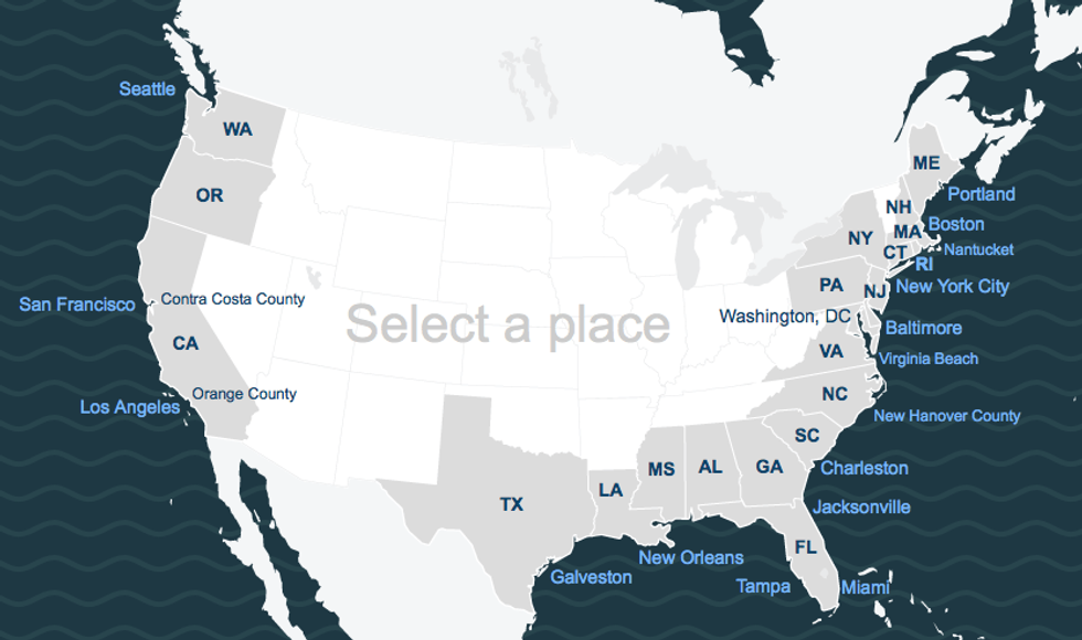
An interactive map creating to mirror the research shows potential flooding in specific states and coastal areas:
The report is based on two just-published peer-reviewed studies, and is the first major national analysis of sea level rise in 20 years, and the first one ever to include:
- Estimates of land, population and housing at risk;
- Evaluations of every low-lying coastal town, city, county and state in the contiguous U.S.;
- Localized timelines of storm surge threats integrating local sea level rise projections; and
- A freely available interactive map and data to download online (see SurgingSeas.org).
Summaries of these findings at a state-by-state level are available in fact sheets and the original peer-reviewed studies are available as well. All findings reflect best estimates from the research; actual values may vary. The summar reads, in part:
This report focuses on new research and analysis, not recommendations; but it is clear from the findings here that in order to avoid the worst impacts, the United States must work to slow sea level rise by reducing emissions of heat-trapping gases, and work to diminish the remaining danger by preparing for higher seas in coastal cities and counties everywhere. SurgingSeas.org/responses/plans lists a selection of existing resources, plans and efforts to prepare, from local to national levels.
###
An Urgent Message From Our Co-Founder
Dear Common Dreams reader, The U.S. is on a fast track to authoritarianism like nothing I've ever seen. Meanwhile, corporate news outlets are utterly capitulating to Trump, twisting their coverage to avoid drawing his ire while lining up to stuff cash in his pockets. That's why I believe that Common Dreams is doing the best and most consequential reporting that we've ever done. Our small but mighty team is a progressive reporting powerhouse, covering the news every day that the corporate media never will. Our mission has always been simple: To inform. To inspire. And to ignite change for the common good. Now here's the key piece that I want all our readers to understand: None of this would be possible without your financial support. That's not just some fundraising cliche. It's the absolute and literal truth. We don't accept corporate advertising and never will. We don't have a paywall because we don't think people should be blocked from critical news based on their ability to pay. Everything we do is funded by the donations of readers like you. Will you donate now to help power the nonprofit, independent reporting of Common Dreams? Thank you for being a vital member of our community. Together, we can keep independent journalism alive when it’s needed most. - Craig Brown, Co-founder |
Rising seas dramatically increase the odds of damaging floods from storm surges. Global warming has raised global sea level about 8 inches since 1880, and the rate of rise is accelerating. These are facts. And now, according to a new analysis by non-profit research organization Climate Central, the level of accelaration may be growing faster than previously thought and odds of "century floods" (or worse) occurring by 2030 are on track to double or more, over widespread areas of the United States.
According to their new report, these floods threaten untold financial damages. "Across the country, nearly 5 million people live in 2.6 million homes at less than 4 feet above high tide -- a level lower than the century flood line for most locations analyzed. And compounding this risk, scientists expect roughly 2 to 7 more feet of sea level rise this century -- a lot depending upon how much more heat-trapping pollution humanity puts into the sky."
The New York Times reports:
If the pace of the rise accelerates as much as expected, researchers found, coastal flooding at levels that were once exceedingly rare could become an every-few-years occurrence by the middle of this century.
By far the most vulnerable state is Florida, the new analysis found, with roughly half of the nation's at-risk population living near the coast on the porous, low-lying limestone shelf that constitutes much of that state. But Louisiana, California, New York and New Jersey are also particularly vulnerable, researchers found, and virtually the entire American coastline is at some degree of risk.
"Sea level rise is like an invisible tsunami, building force while we do almost nothing," said Benjamin H. Strauss, an author, with other scientists, of two new papers outlining the research. "We have a closing window of time to prevent the worst by preparing for higher seas."
An interactive map creating to mirror the research shows potential flooding in specific states and coastal areas:
The report is based on two just-published peer-reviewed studies, and is the first major national analysis of sea level rise in 20 years, and the first one ever to include:
- Estimates of land, population and housing at risk;
- Evaluations of every low-lying coastal town, city, county and state in the contiguous U.S.;
- Localized timelines of storm surge threats integrating local sea level rise projections; and
- A freely available interactive map and data to download online (see SurgingSeas.org).
Summaries of these findings at a state-by-state level are available in fact sheets and the original peer-reviewed studies are available as well. All findings reflect best estimates from the research; actual values may vary. The summar reads, in part:
This report focuses on new research and analysis, not recommendations; but it is clear from the findings here that in order to avoid the worst impacts, the United States must work to slow sea level rise by reducing emissions of heat-trapping gases, and work to diminish the remaining danger by preparing for higher seas in coastal cities and counties everywhere. SurgingSeas.org/responses/plans lists a selection of existing resources, plans and efforts to prepare, from local to national levels.
###


