As Climate Floods Surge, Taxpayers On Hook to Insure Homes of the 1%
NBC report shows FEMA redrawing flood maps to pass costs of storm insurance from ultra-rich to everyone else

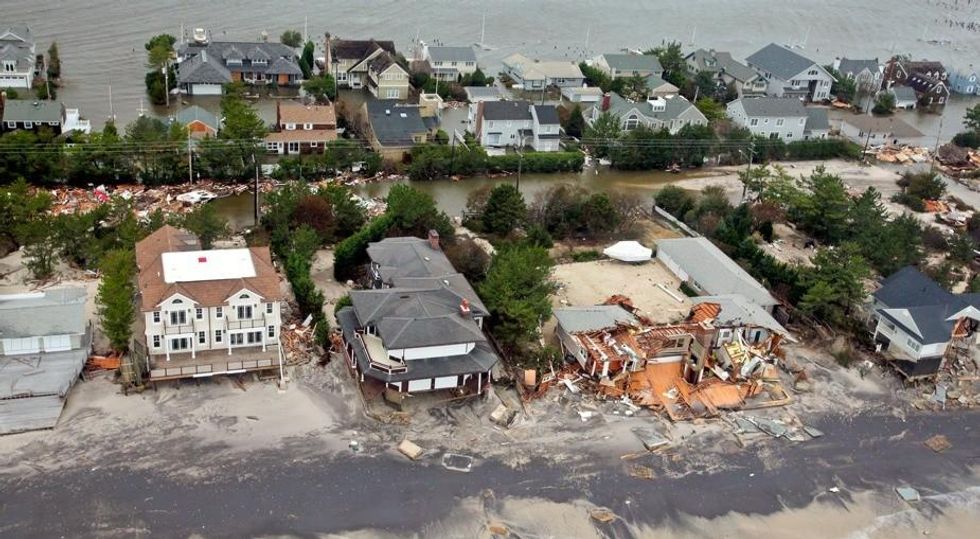
Public records show more than 500 instances across the country in which FEMA re-mapped high-end condos and mansions to change their classification from being in a highest-risk flood zone to a lower-risk one, according to the report. FEMA has deemed at least some properties lower risk despite previous flood-related claims, and over the objections of local officials.
"Carving the flood zone map like a parent cutting a notch in a jack-o'-lantern to make a tooth, FEMA moves the lines on a map for one property, while leaving its neighbors in the higher-risk zone," explains Dedman.
The new classification saves owners of these high-end properties up to 97 percent on premiums paid to the National Flood Insurance Program. Yet, these same properties can still collect on federal insurance money when their properties are damaged. The result: from the Gulf of Alaska to Bar Harbor, Maine, to Orange Beach, Alabama, wealthy coastal property owners are bailed out by U.S. taxpayers for the damage wrought by climate change.
_____________________
An Urgent Message From Our Co-Founder
Dear Common Dreams reader, The U.S. is on a fast track to authoritarianism like nothing I've ever seen. Meanwhile, corporate news outlets are utterly capitulating to Trump, twisting their coverage to avoid drawing his ire while lining up to stuff cash in his pockets. That's why I believe that Common Dreams is doing the best and most consequential reporting that we've ever done. Our small but mighty team is a progressive reporting powerhouse, covering the news every day that the corporate media never will. Our mission has always been simple: To inform. To inspire. And to ignite change for the common good. Now here's the key piece that I want all our readers to understand: None of this would be possible without your financial support. That's not just some fundraising cliche. It's the absolute and literal truth. We don't accept corporate advertising and never will. We don't have a paywall because we don't think people should be blocked from critical news based on their ability to pay. Everything we do is funded by the donations of readers like you. Will you donate now to help power the nonprofit, independent reporting of Common Dreams? Thank you for being a vital member of our community. Together, we can keep independent journalism alive when it’s needed most. - Craig Brown, Co-founder |

Public records show more than 500 instances across the country in which FEMA re-mapped high-end condos and mansions to change their classification from being in a highest-risk flood zone to a lower-risk one, according to the report. FEMA has deemed at least some properties lower risk despite previous flood-related claims, and over the objections of local officials.
"Carving the flood zone map like a parent cutting a notch in a jack-o'-lantern to make a tooth, FEMA moves the lines on a map for one property, while leaving its neighbors in the higher-risk zone," explains Dedman.
The new classification saves owners of these high-end properties up to 97 percent on premiums paid to the National Flood Insurance Program. Yet, these same properties can still collect on federal insurance money when their properties are damaged. The result: from the Gulf of Alaska to Bar Harbor, Maine, to Orange Beach, Alabama, wealthy coastal property owners are bailed out by U.S. taxpayers for the damage wrought by climate change.
_____________________

