
SUBSCRIBE TO OUR FREE NEWSLETTER
Daily news & progressive opinion—funded by the people, not the corporations—delivered straight to your inbox.
5
#000000
#FFFFFF
To donate by check, phone, or other method, see our More Ways to Give page.


Daily news & progressive opinion—funded by the people, not the corporations—delivered straight to your inbox.
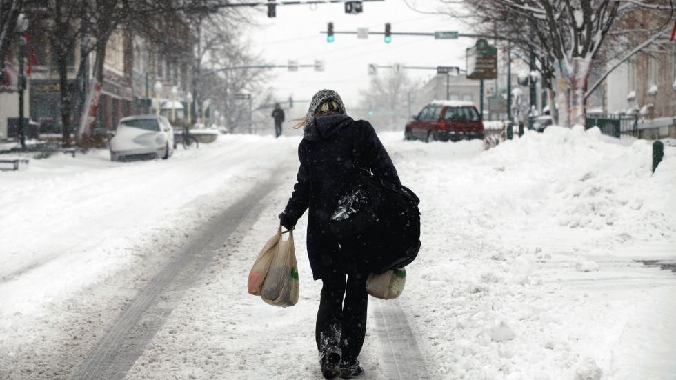
Winter storm Euclid continues its assault on the US today as it pounds New England with heavy snow while scientists caution that monumental snowfalls are a sign of things to come.
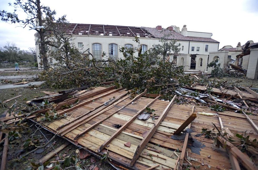
On Christmas Day a massive swath of the country experienced weather so extreme it will likely go down in history as the worst Dec. 25 tornado outbreak on record.
Co-founder and director of meteorology at the Weather Underground, Dr. Jeff Master, writes:
The impressive storm is highly likely to set a record for most tornadoes spawned on Christmas Day, as 11 tornadoes have been confirmed, and there are at least 14 other suspected tornadoes that occurred. The most tornadoes ever recorded on Christmas Day was twelve, back in 1969. The storm spawned an additional confirmed tornado on December 26 in North Carolina.
He says that at least two of the Christmas Day tornadoes were rated EF-3 on the Enhanced Fujita scale, which rates the strength of tornadoes based on the damage they cause; only four other EF-3 tornadoes have been recorded on Christmas Day since 1950.
"The EF-3 that hit Pennington, in Southeast Texas, completely destroyed a feed store and a restaurant, and had winds up to 150 mph. The other EF-3 hit McNeil, Mississippi, and was rated a weak EF-3 with winds of 140 mph. The tornado cut a path 24 miles long, injured 8 people, and damaged or destroyed 46 homes," Master reports.
Watch this video taken from a store surveillance camera, of a tornado hitting Mobile, Al.
The Weather Channel, which has taken it upon itself to begin naming winter storms, says that by the time it's done Euclid "will have deposited snow from California's Sierra Nevada Mountains to New England" with up to 2 feet of snow expected in some areas of northern New England by the time the system moves out to sea late Thursday.
Climate Central's Andrew Freedman writes that "snow accompanied by lightning and thunder--a combo known as "thundersnow"--was observed in several states, including Arkansas, Ohio, and Indiana. Thundersnow is an indication of tremendous vertical motion of air taking place in the atmosphere, which can lead to heavy snowfall rates of 2 or more inches per hour.
In a video by Climate Central, scientist Jay Lawrimore and meteorologist Dan Satterfield explain how increased temperatures can affect the formation of snowstorms.
"Strange as it may seem that there can be more severe snow storms in a warming climate, thats in fact what we've observed over the past couple decades. Increasing temperatures actually increases the amount of moisture in the atmosphere that can lead to heavier snow storms," Lawrimore says.
Satterfield adds:
I get a lot of feedback from viewers when I talk about a big snow event coming, saying "What do you think about climate change now?" If you add that moisture into the atmosphere, you're gonna get more snow, and we're gonna get storms that are heavier. And I think that's something that's hard for the non-scientist non-weather geek to get their head around, that this heavy snowstorm could actually be related to increasing temperatures on the planet, but there's no doubt about it.
According to the Associated Press, the death toll has risen to at least 15 people--most of which were either related to traffic fatalities or fallen trees.


Dear Common Dreams reader, The U.S. is on a fast track to authoritarianism like nothing I've ever seen. Meanwhile, corporate news outlets are utterly capitulating to Trump, twisting their coverage to avoid drawing his ire while lining up to stuff cash in his pockets. That's why I believe that Common Dreams is doing the best and most consequential reporting that we've ever done. Our small but mighty team is a progressive reporting powerhouse, covering the news every day that the corporate media never will. Our mission has always been simple: To inform. To inspire. And to ignite change for the common good. Now here's the key piece that I want all our readers to understand: None of this would be possible without your financial support. That's not just some fundraising cliche. It's the absolute and literal truth. We don't accept corporate advertising and never will. We don't have a paywall because we don't think people should be blocked from critical news based on their ability to pay. Everything we do is funded by the donations of readers like you. Will you donate now to help power the nonprofit, independent reporting of Common Dreams? Thank you for being a vital member of our community. Together, we can keep independent journalism alive when it’s needed most. - Craig Brown, Co-founder |
Winter storm Euclid continues its assault on the US today as it pounds New England with heavy snow while scientists caution that monumental snowfalls are a sign of things to come.
On Christmas Day a massive swath of the country experienced weather so extreme it will likely go down in history as the worst Dec. 25 tornado outbreak on record.
Co-founder and director of meteorology at the Weather Underground, Dr. Jeff Master, writes:
The impressive storm is highly likely to set a record for most tornadoes spawned on Christmas Day, as 11 tornadoes have been confirmed, and there are at least 14 other suspected tornadoes that occurred. The most tornadoes ever recorded on Christmas Day was twelve, back in 1969. The storm spawned an additional confirmed tornado on December 26 in North Carolina.
He says that at least two of the Christmas Day tornadoes were rated EF-3 on the Enhanced Fujita scale, which rates the strength of tornadoes based on the damage they cause; only four other EF-3 tornadoes have been recorded on Christmas Day since 1950.
"The EF-3 that hit Pennington, in Southeast Texas, completely destroyed a feed store and a restaurant, and had winds up to 150 mph. The other EF-3 hit McNeil, Mississippi, and was rated a weak EF-3 with winds of 140 mph. The tornado cut a path 24 miles long, injured 8 people, and damaged or destroyed 46 homes," Master reports.
Watch this video taken from a store surveillance camera, of a tornado hitting Mobile, Al.
The Weather Channel, which has taken it upon itself to begin naming winter storms, says that by the time it's done Euclid "will have deposited snow from California's Sierra Nevada Mountains to New England" with up to 2 feet of snow expected in some areas of northern New England by the time the system moves out to sea late Thursday.
Climate Central's Andrew Freedman writes that "snow accompanied by lightning and thunder--a combo known as "thundersnow"--was observed in several states, including Arkansas, Ohio, and Indiana. Thundersnow is an indication of tremendous vertical motion of air taking place in the atmosphere, which can lead to heavy snowfall rates of 2 or more inches per hour.
In a video by Climate Central, scientist Jay Lawrimore and meteorologist Dan Satterfield explain how increased temperatures can affect the formation of snowstorms.
"Strange as it may seem that there can be more severe snow storms in a warming climate, thats in fact what we've observed over the past couple decades. Increasing temperatures actually increases the amount of moisture in the atmosphere that can lead to heavier snow storms," Lawrimore says.
Satterfield adds:
I get a lot of feedback from viewers when I talk about a big snow event coming, saying "What do you think about climate change now?" If you add that moisture into the atmosphere, you're gonna get more snow, and we're gonna get storms that are heavier. And I think that's something that's hard for the non-scientist non-weather geek to get their head around, that this heavy snowstorm could actually be related to increasing temperatures on the planet, but there's no doubt about it.
According to the Associated Press, the death toll has risen to at least 15 people--most of which were either related to traffic fatalities or fallen trees.
